


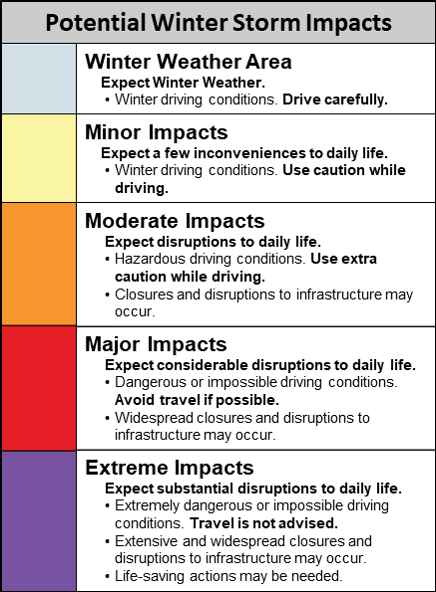
Winter Storm Severity Index (WSSI)
The WSSI does not depict official warnings and should always be used in context with official NWS forecasts and warnings.
For a users guide and more information about the WSSI, please select from the dropdown menu below.
Overall Impact:
Maximum impact from any of the components.
Snow Amount:
Potential impact from snow amount and snow rate.
Snow Load:
Potential impact from the weight of snow on
structures.
Ice Accumulation:
Potential impact from the ice accumulation and
wind.
Flash Freeze:
Potential impact from rapid decreases in temperature
from
above to below freezing with the presence of liquid water.
Blowing Snow:
Potential impact from falling snow combined with
wind.
Ground Blizzard:
Potential impact from snow on the ground
combined
with wind.
|
|---|
|
Change image opacity:
|
|
|
| |||||||||||
|
|