|
|
 |
 |
||
 |
| Site Map | News | Organization |
| DOC | NOAA | NWS | NCEP Centers: | AWC | CPC | EMC | NCO | NHC | OPC | SPC | SWPC | WPC |
|
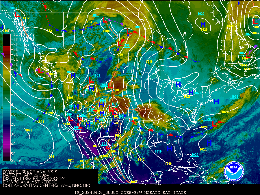
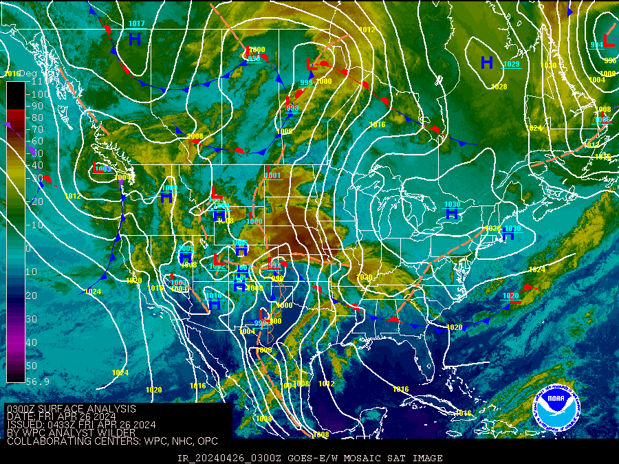
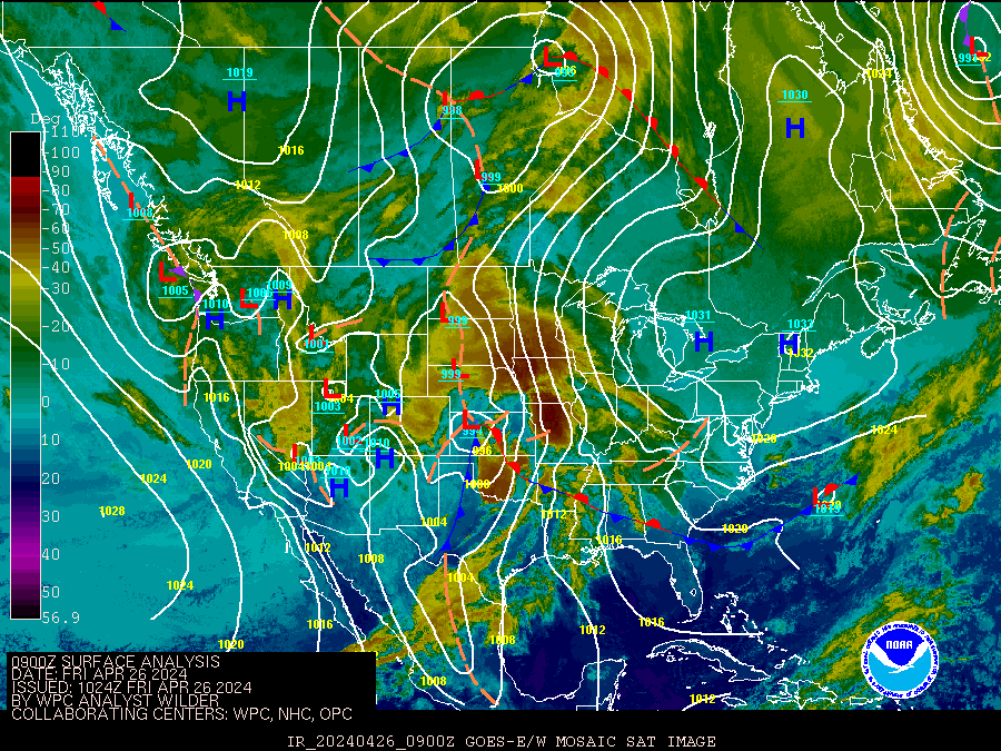
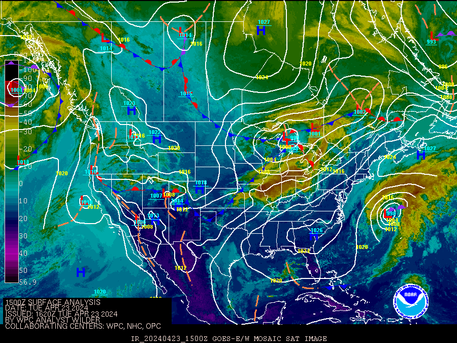
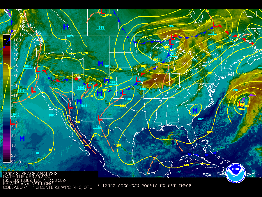
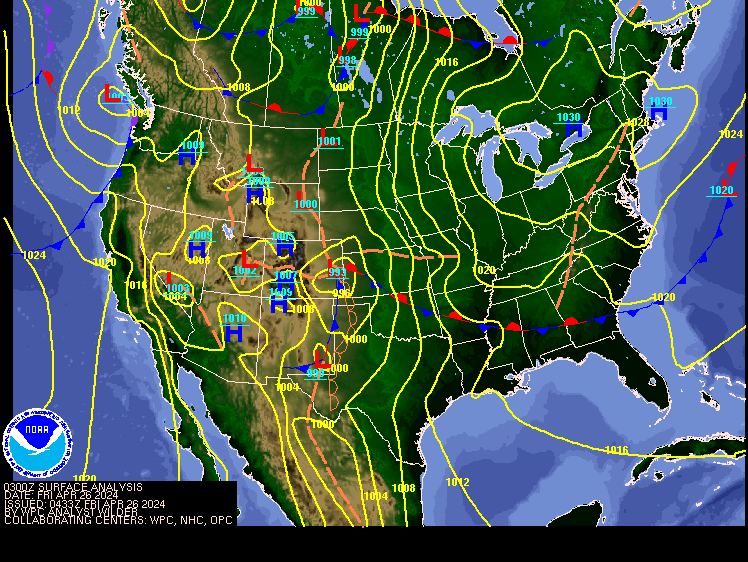
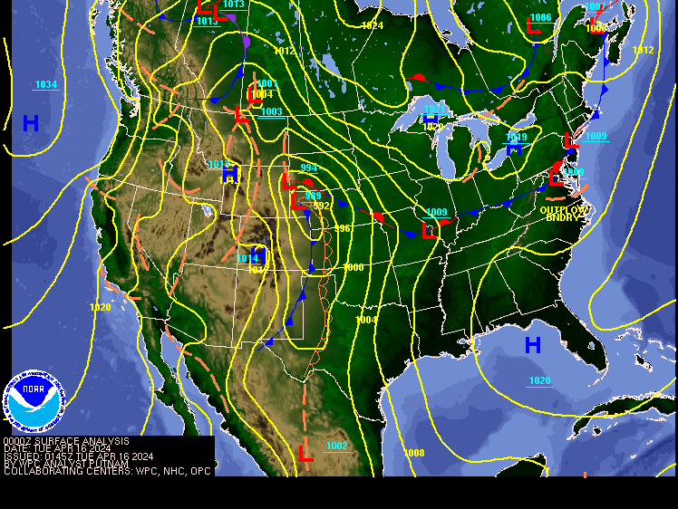
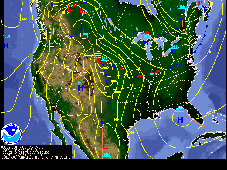
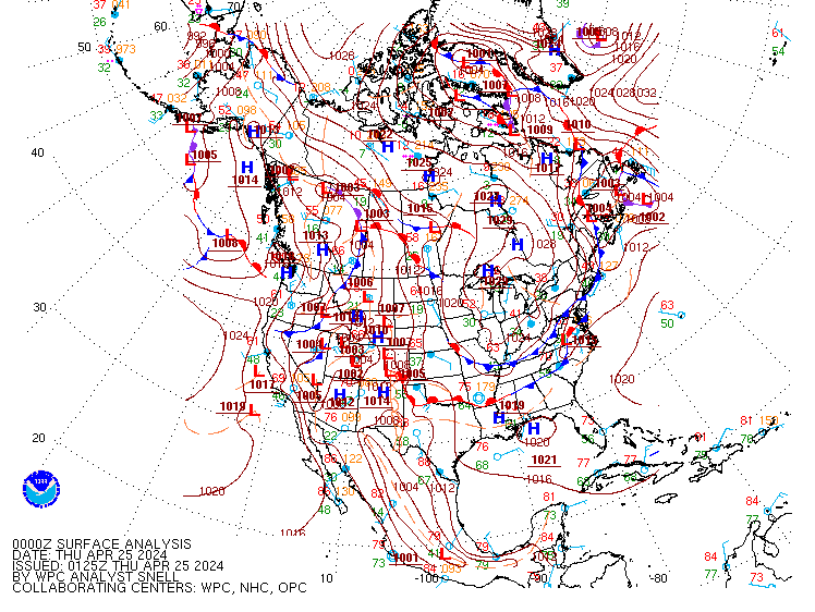
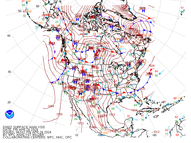
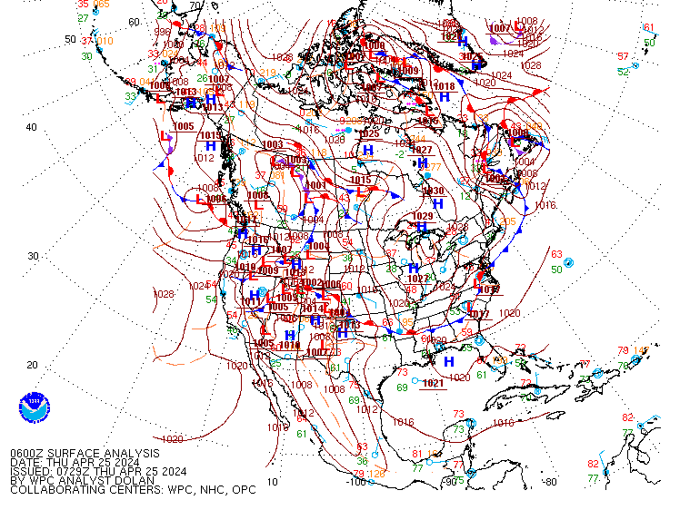
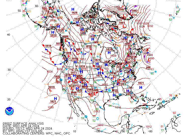
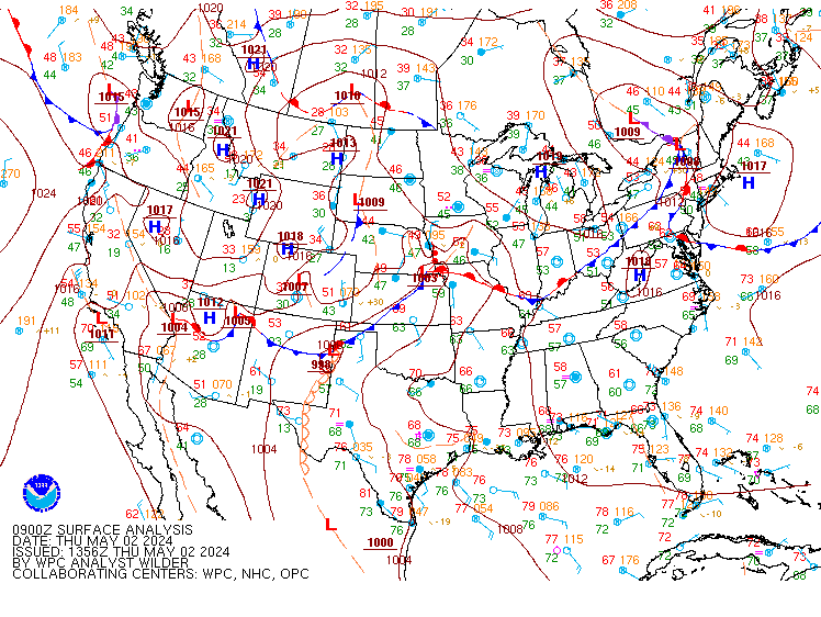
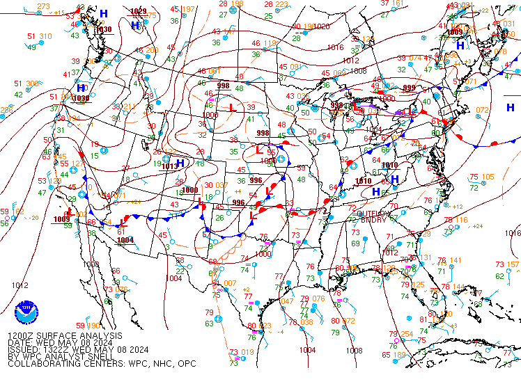
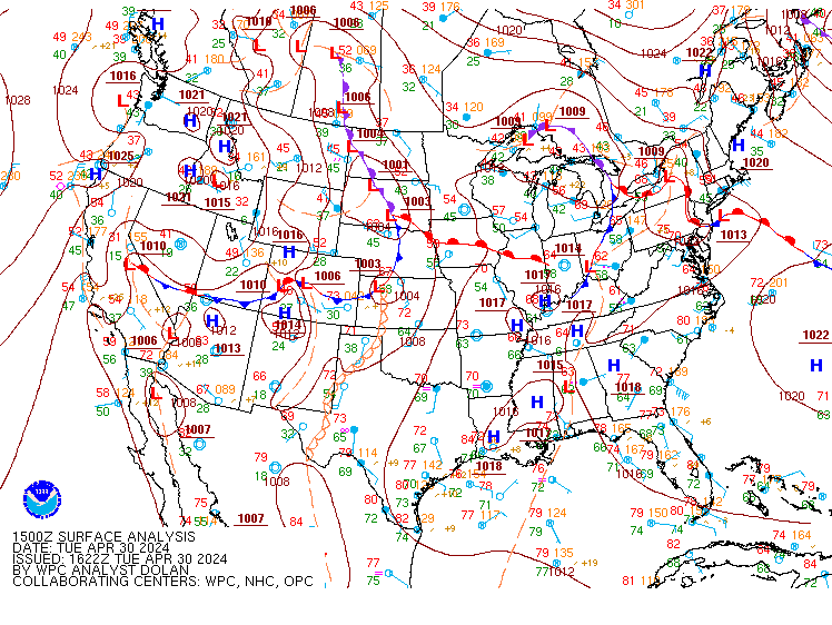
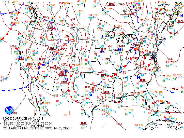
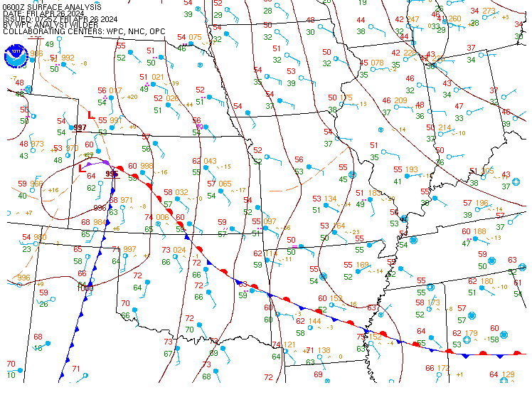
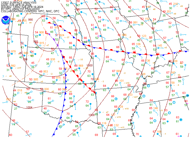
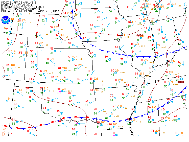
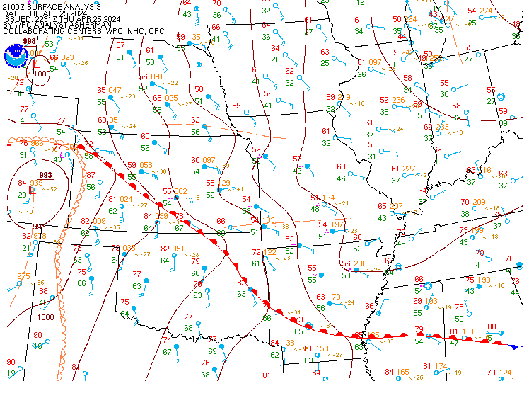
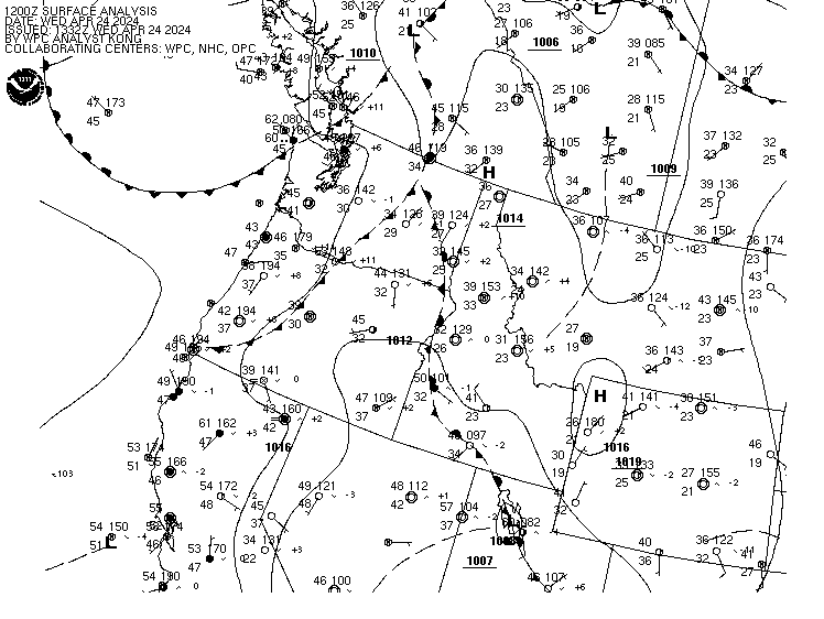
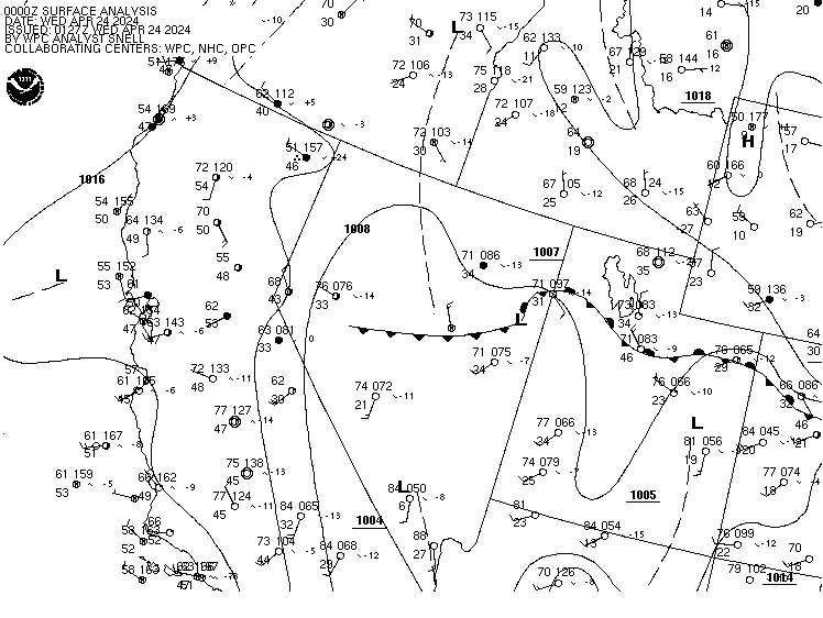
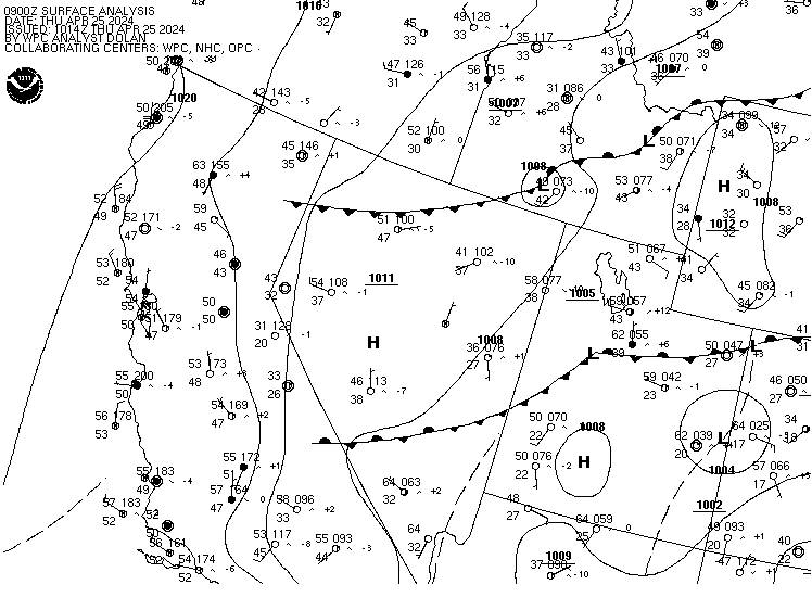
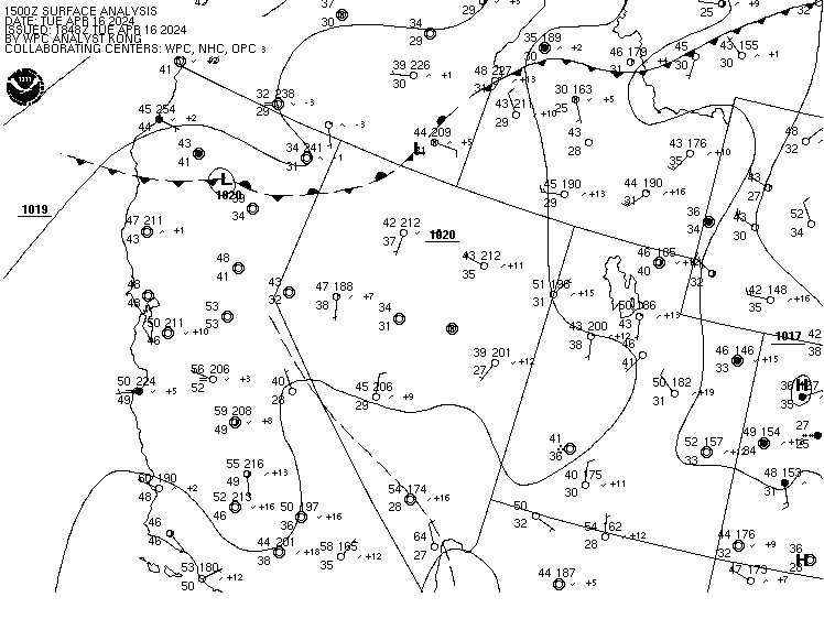
Click here to view a list of WPC Surface Analysis
products
*May require a special TIFF viewer. Click here for more information.
**Opens in a new tab or window and is a pdf file (requires Adobe Acrobat Reader to view).
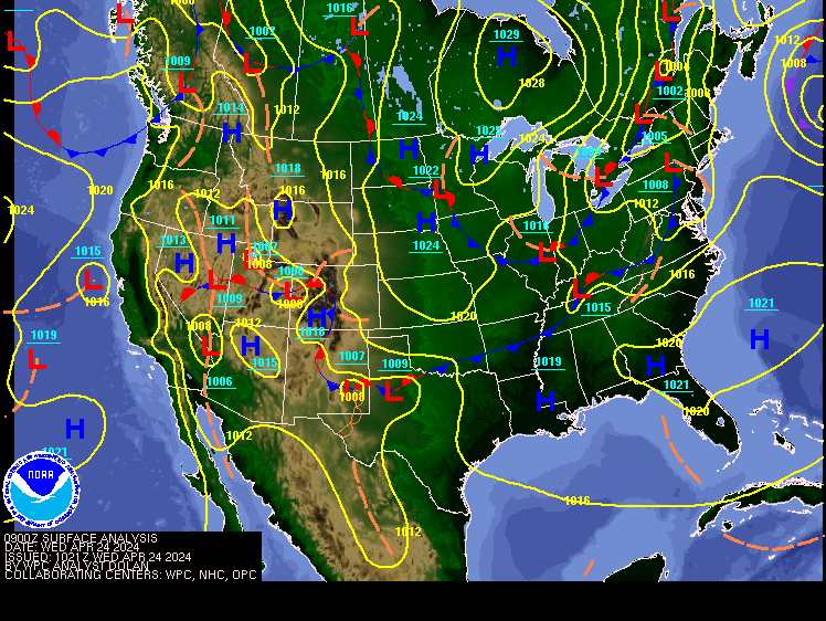
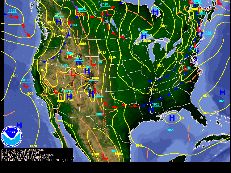
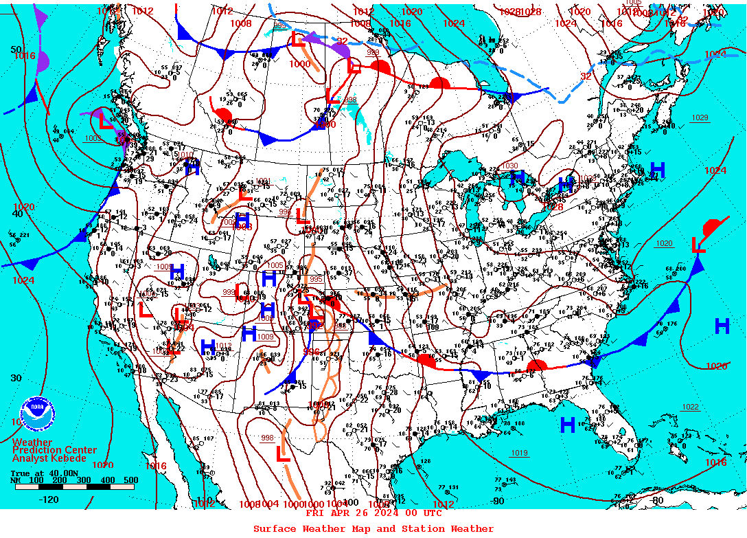
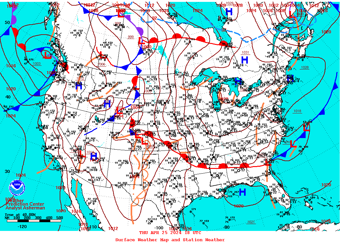
Surface Analysis Products Table
All products are in color on a white background except when overlayed
on satellite imagery.
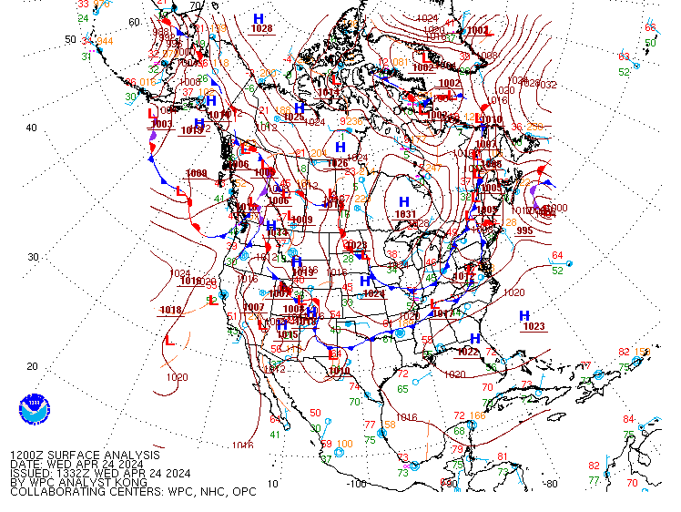
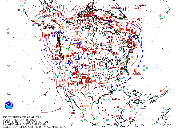
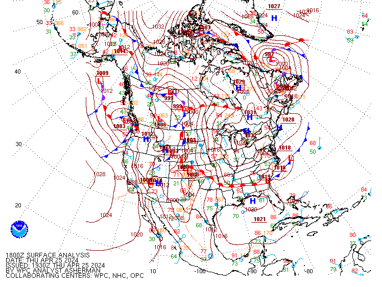
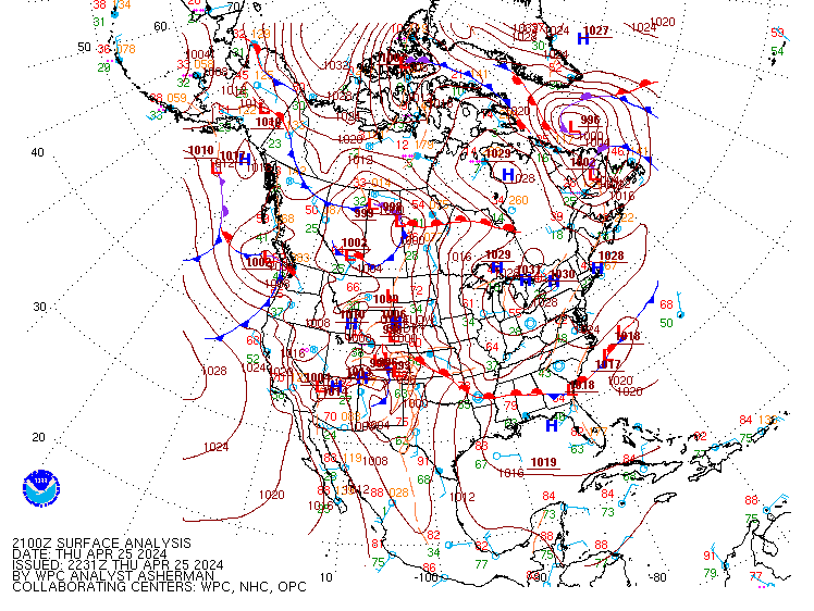
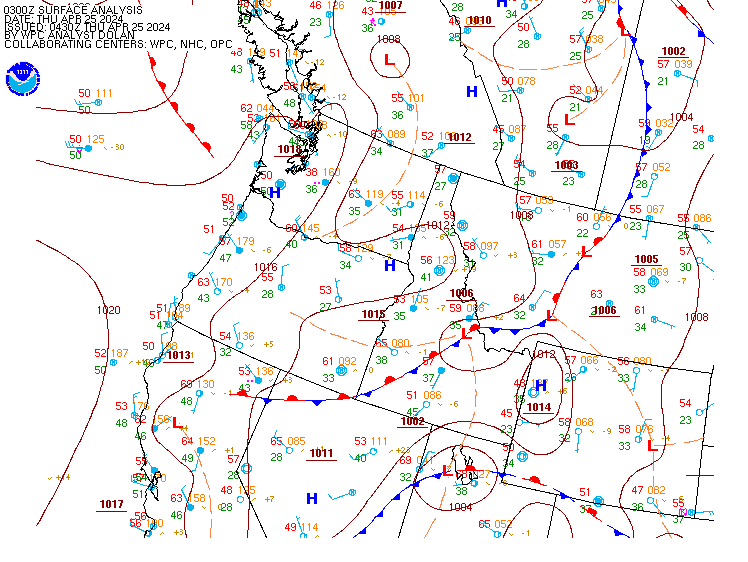
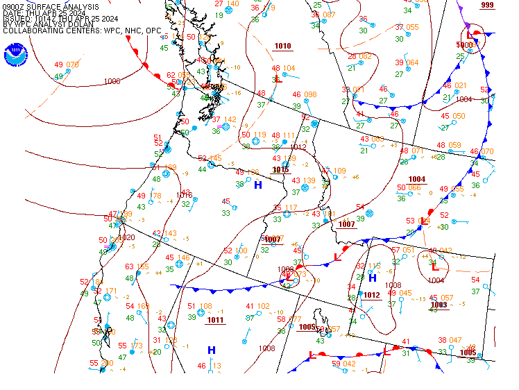
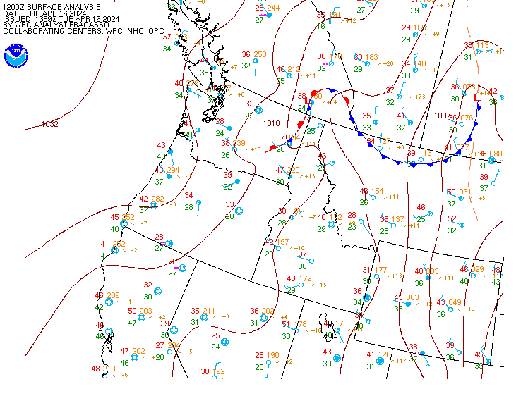
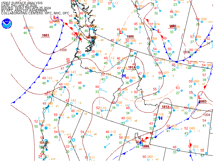
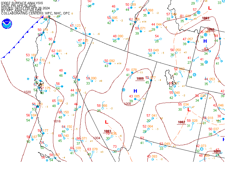
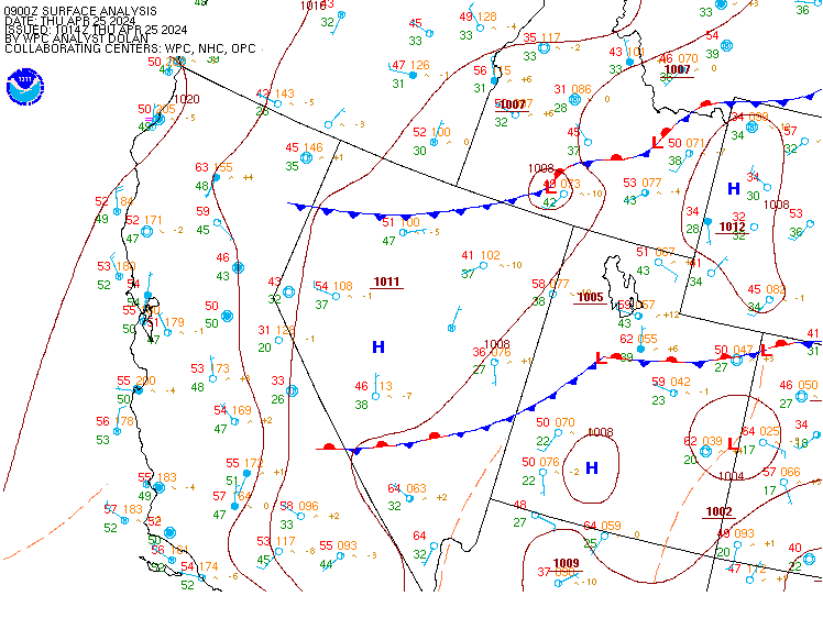
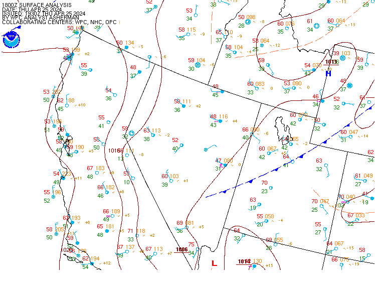
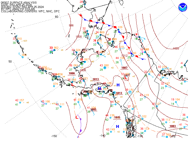
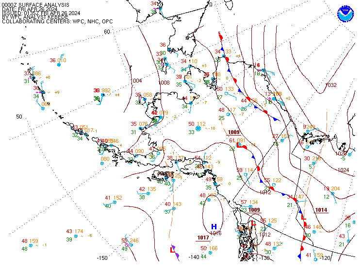
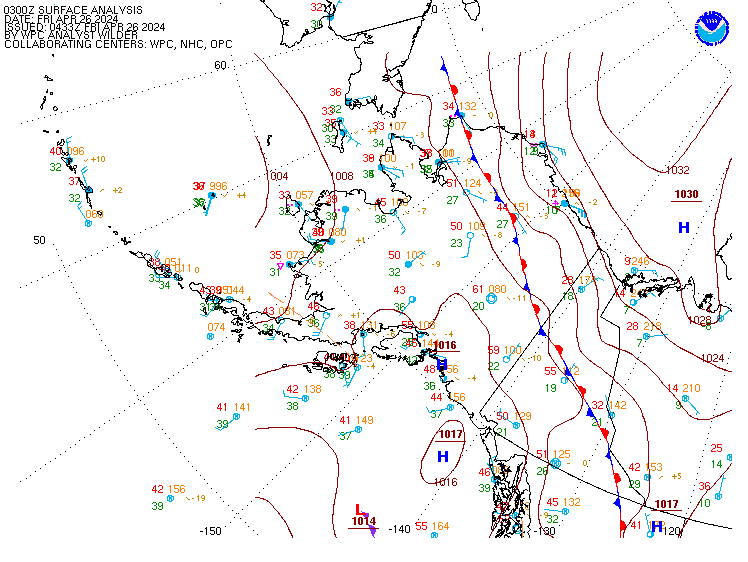
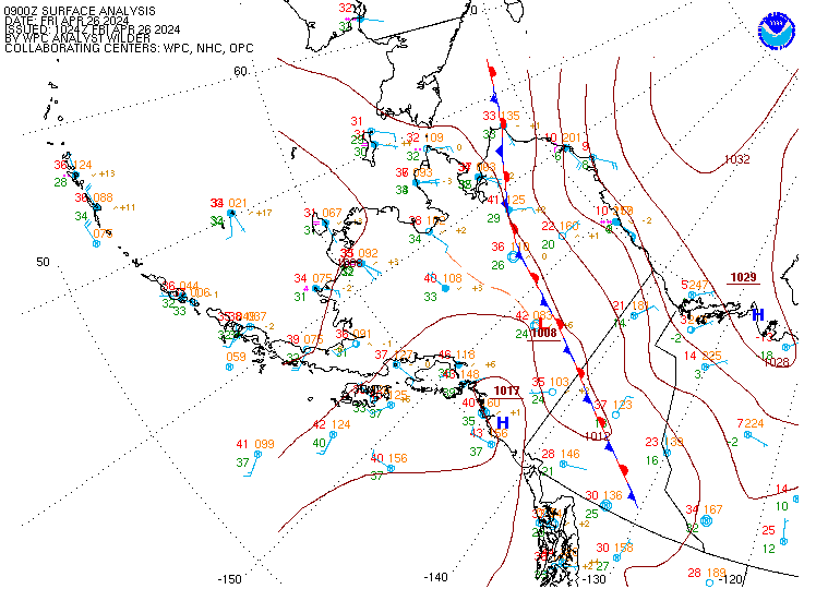
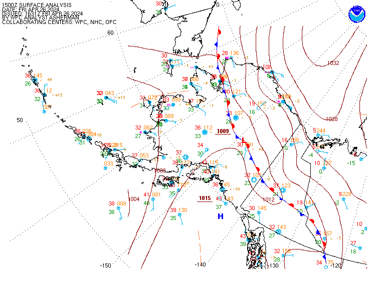
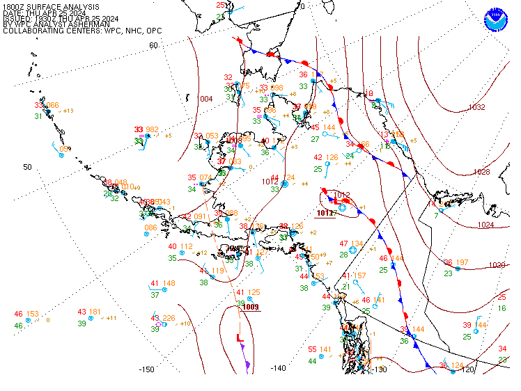
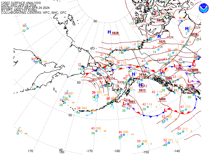
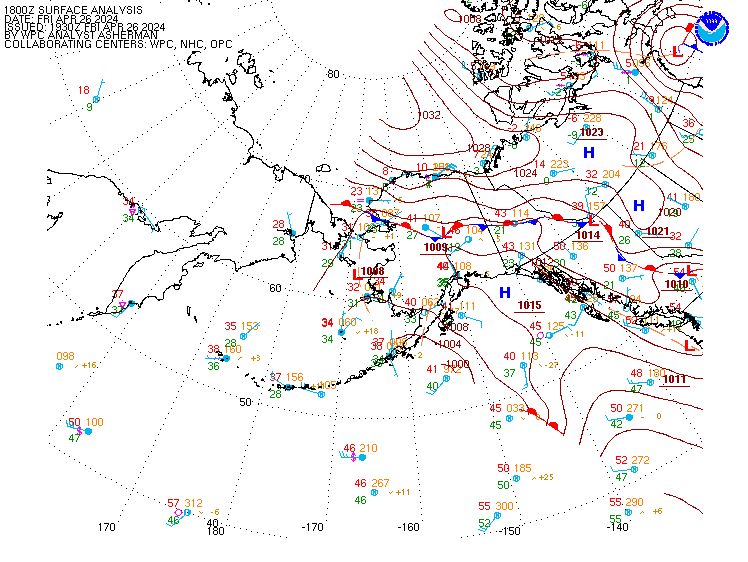
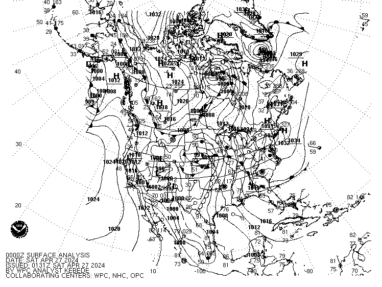
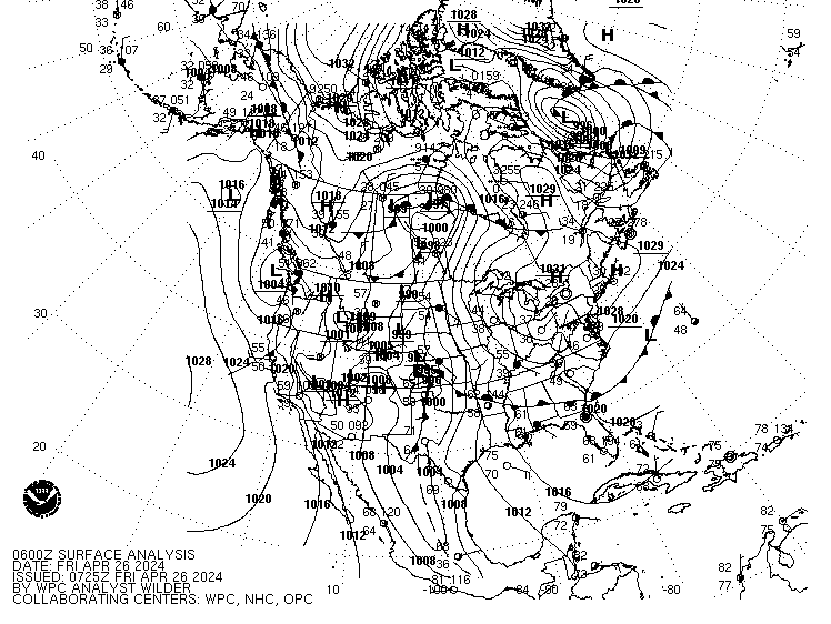
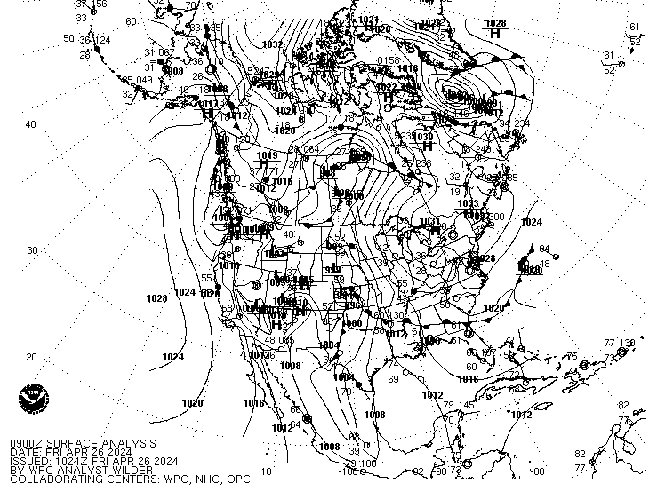
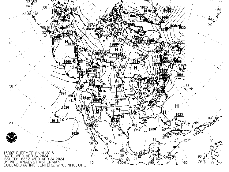
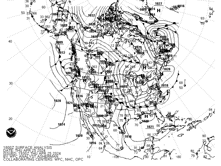
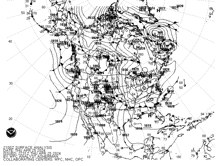
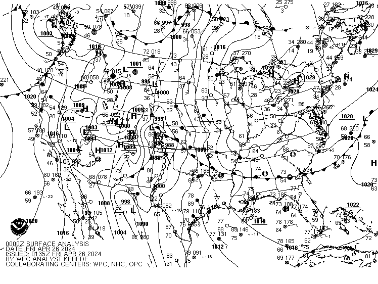
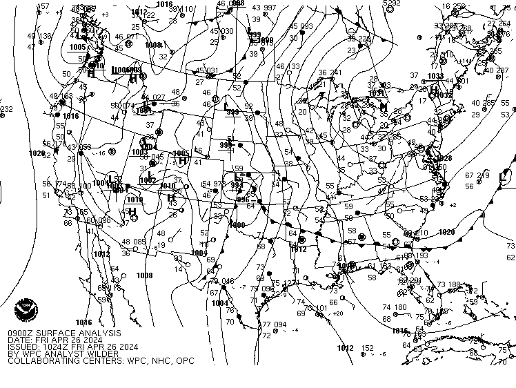
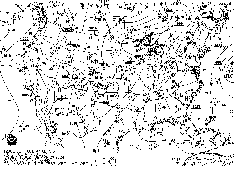
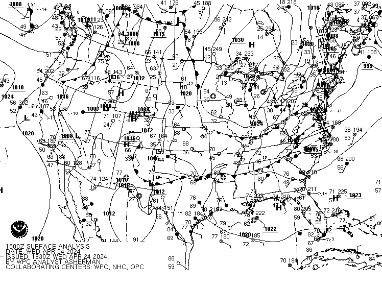
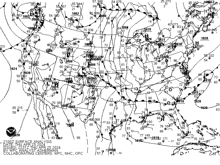
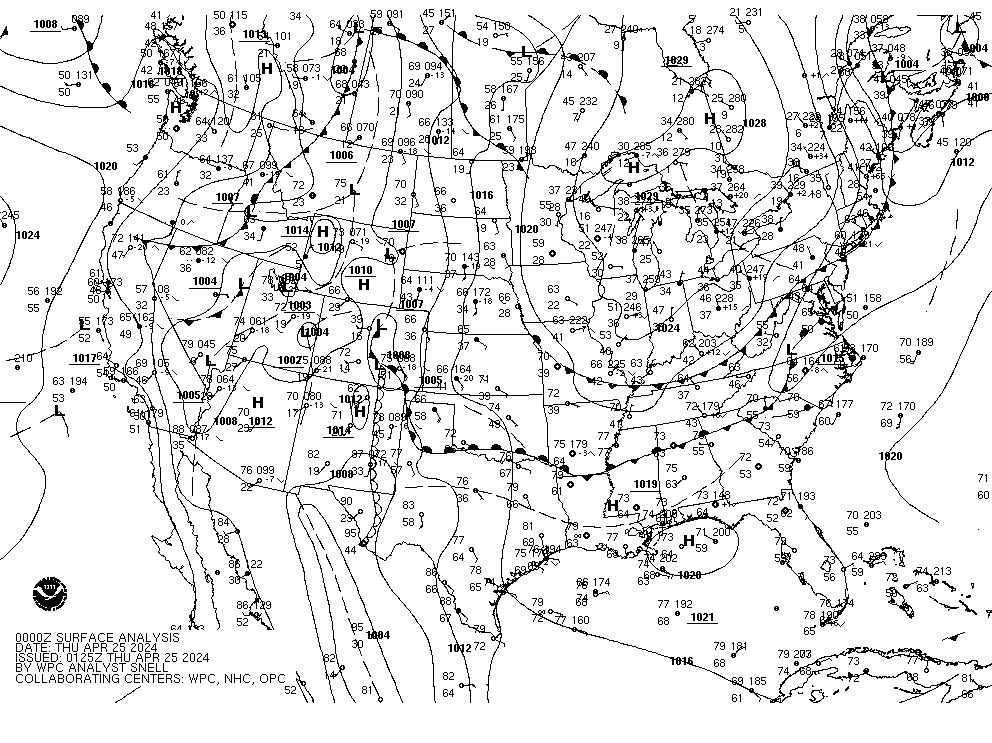
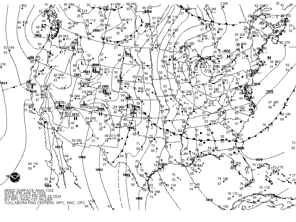
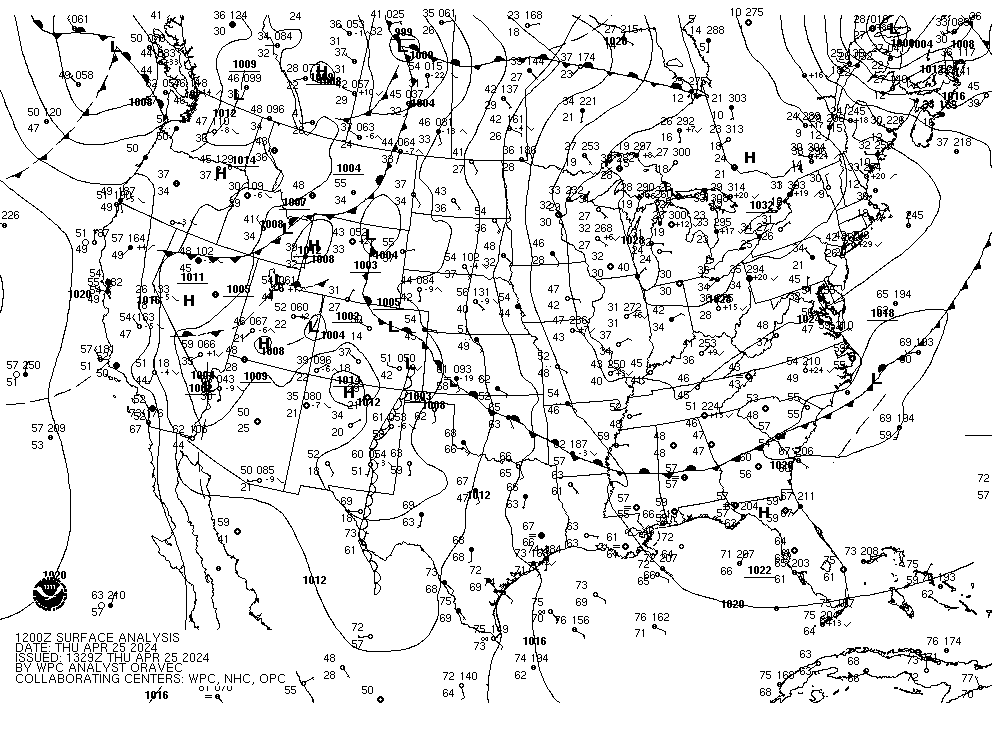
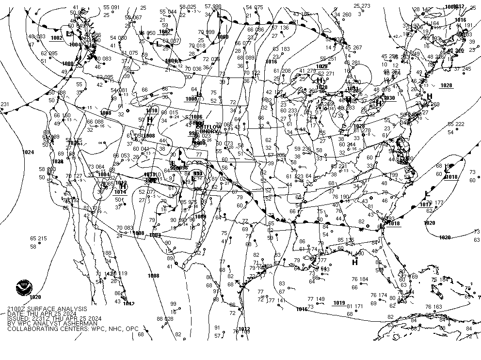
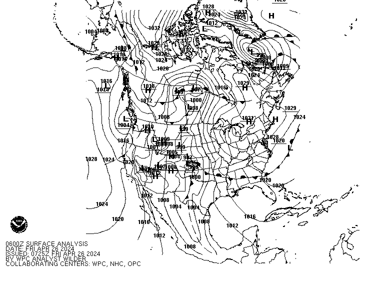
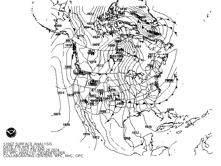
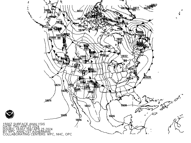
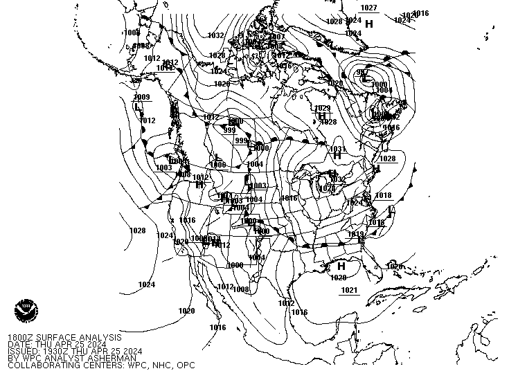
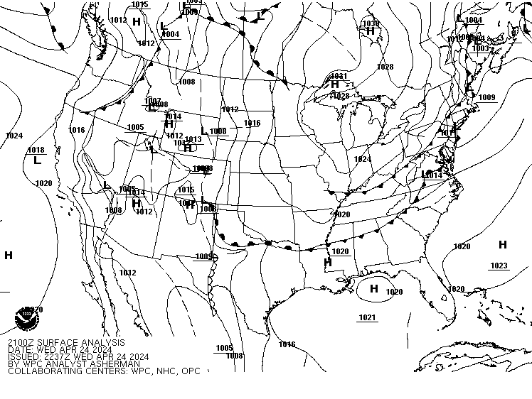
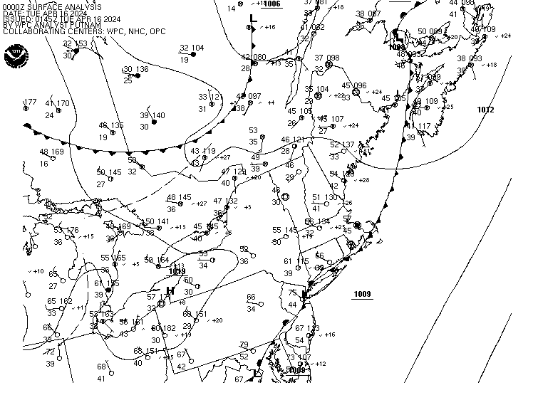
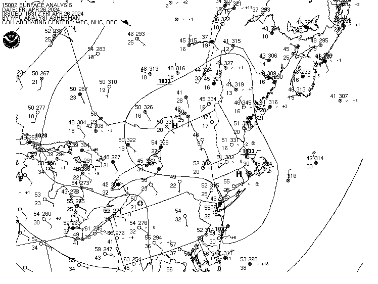
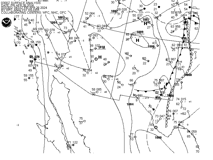
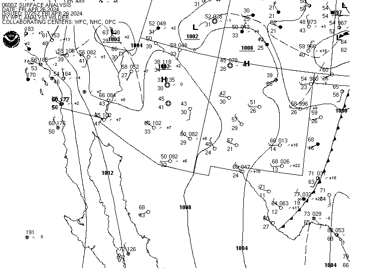
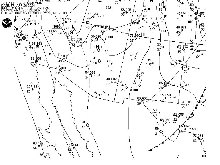
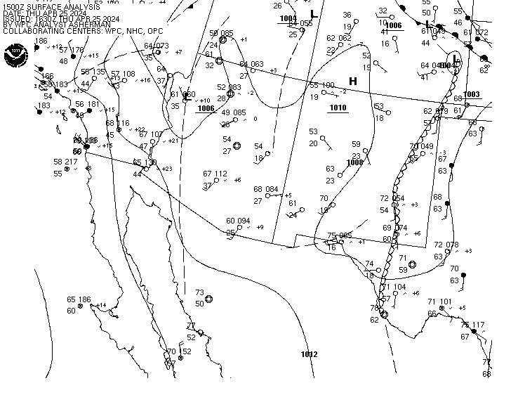
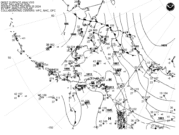
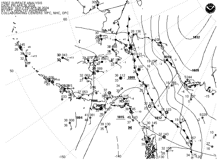
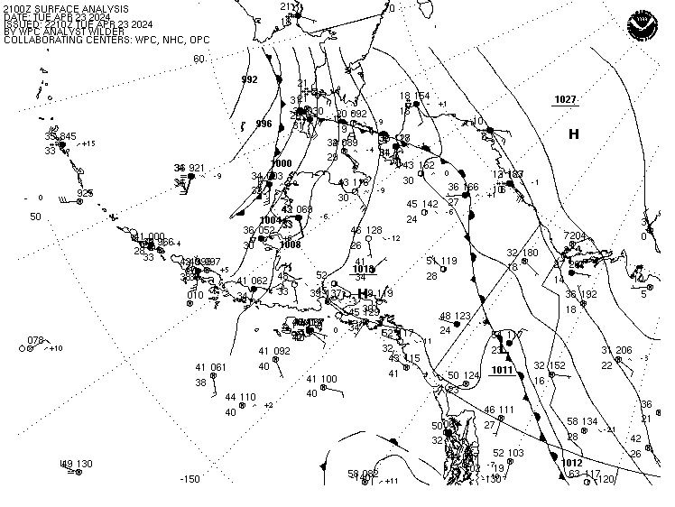
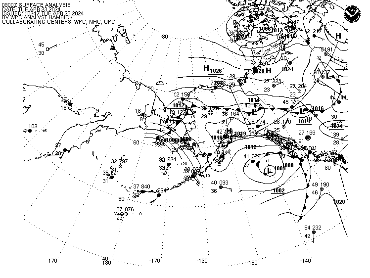
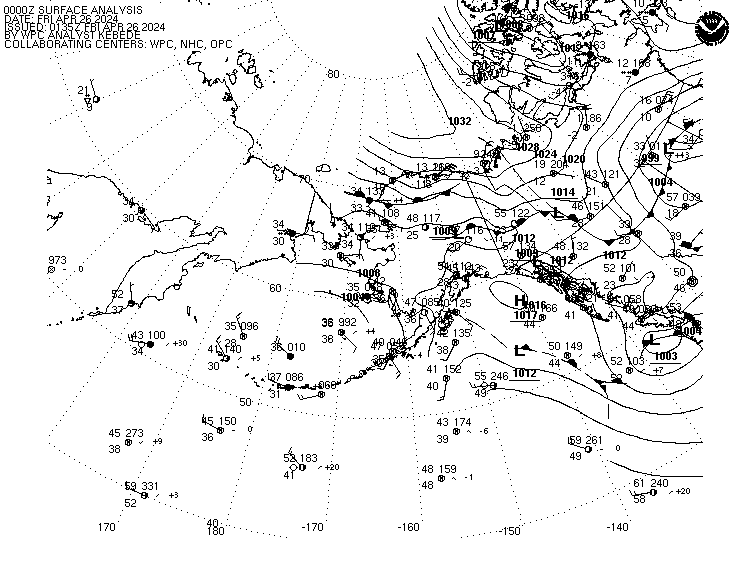
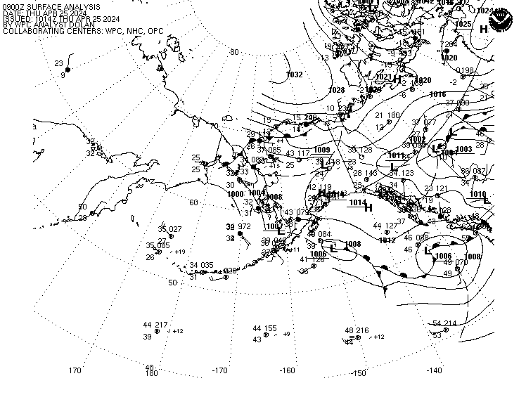
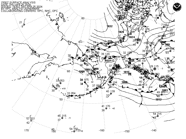
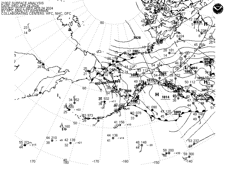
Coded Surface Bulletin: Latest 00Z 03Z 06Z 09Z 12Z 15Z 18Z 21Z
00Z 03Z 06Z 09Z 12Z 15Z 18Z 21Z
Black and White Surface Analysis Products
View Surface Analyses for Aviation Interests
Current Weather Conditions at WPC
NWS Unified Surface Analysis Manual
|
||||||||||||||||||||||||||||||||||||||||||||||||||||||||||||||||||||||||||||||||||||||||||||||||||||||||||||||||||||||||||||||||||||||||||||||||
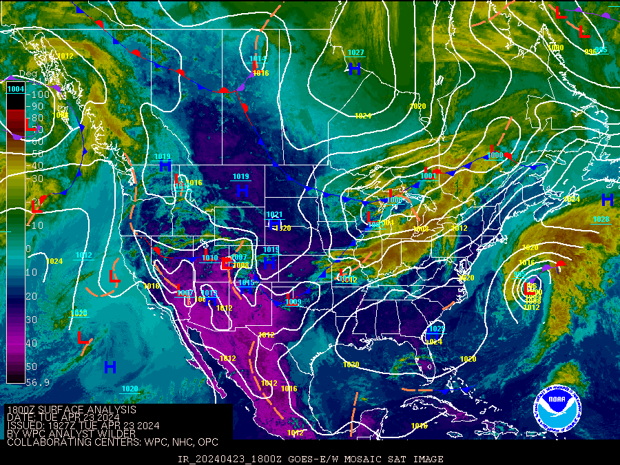
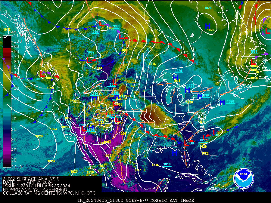
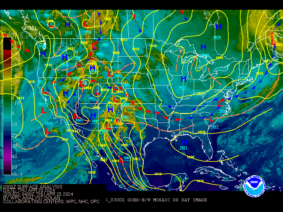
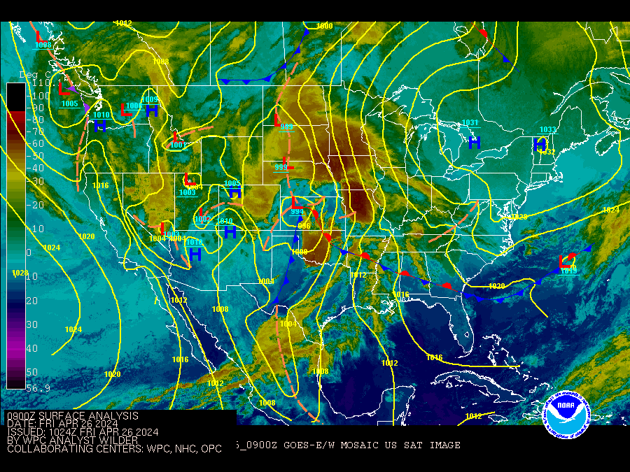
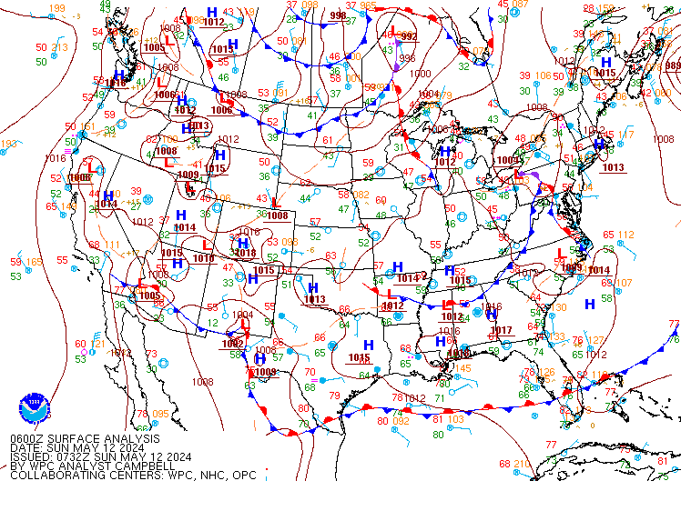
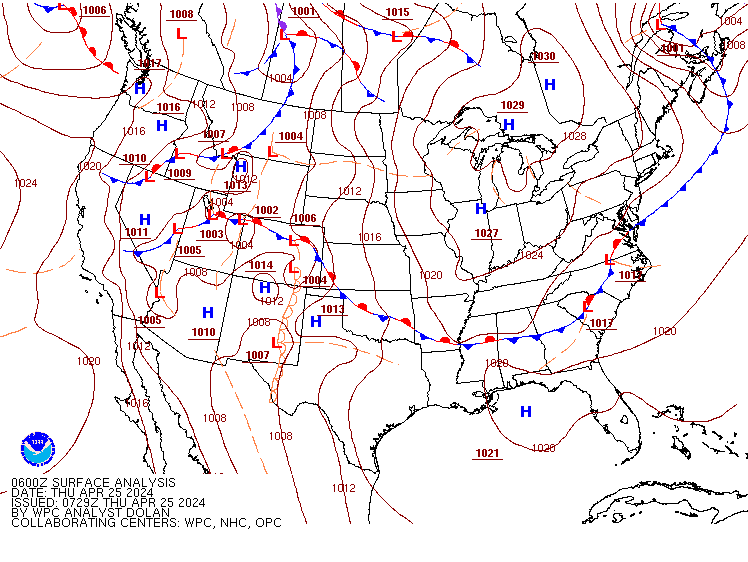
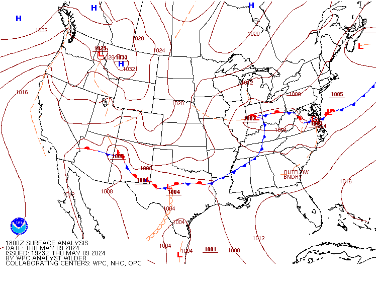
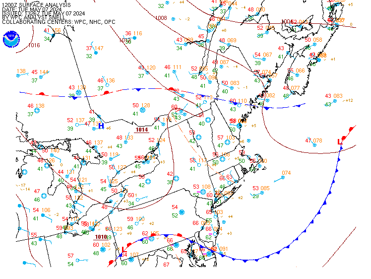
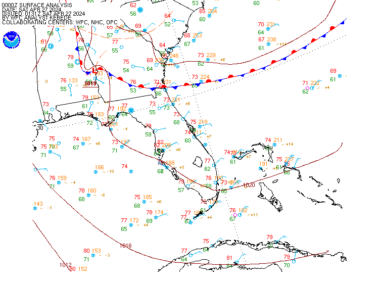
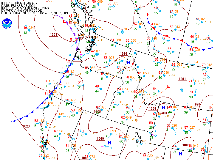
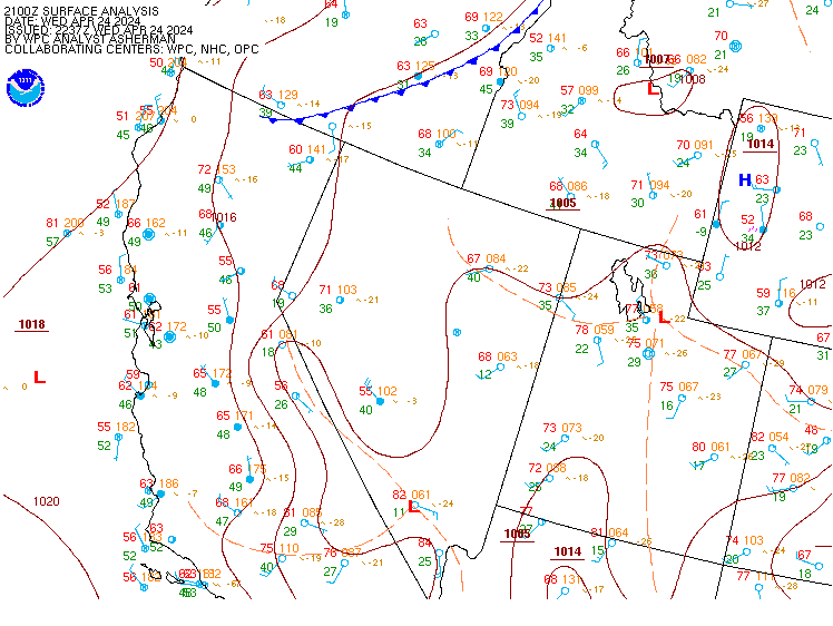
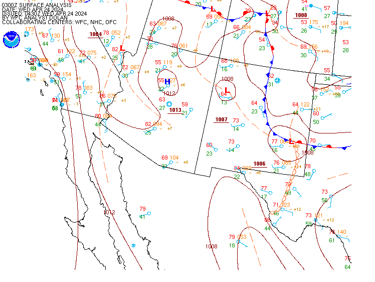
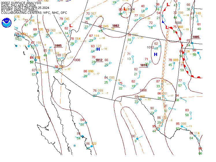
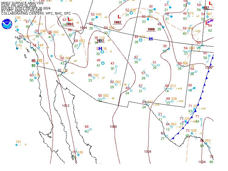
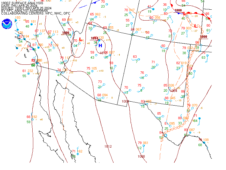
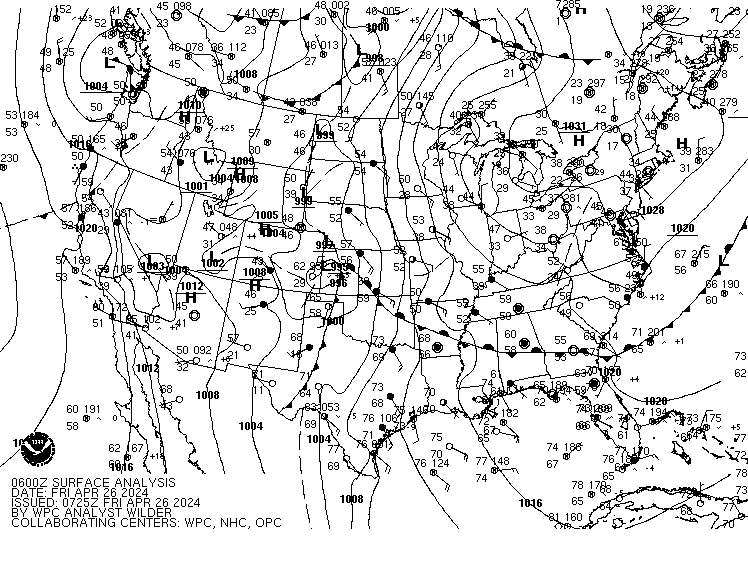
![[current sfc analysis]](/sfc/90fwbg.gif)
![[Black and White Image]](/sfc/90fbw.gif)
![[Color]](/sfc/namfntsfcwbg.gif)
![[B/W]](/sfc/namfntsfcbw.gif)
![[Color]](/sfc/namussfcwbg.gif)
![[B/W]](/sfc/namussfcbw.gif)
![[Color]](/sfc/usfntsfcwbg.gif)
![[B/W]](/sfc/usfntsfcbw.gif)