Extended Forecast Discussion
NWS Weather Prediction Center College Park MD
254 PM EDT Thu Jun 27 2024
Valid 12Z Sun Jun 30 2024 - 12Z Thu Jul 04 2024
...Hazardous heat threats to focus for parts of the South and
vicinity this weekend and well into next week...
...Overview...
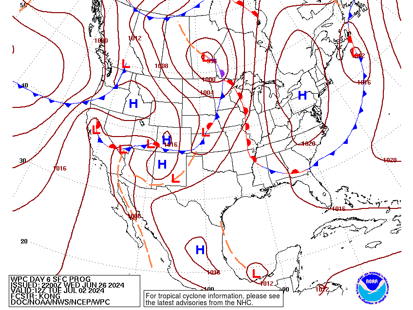
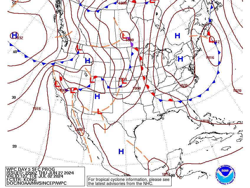
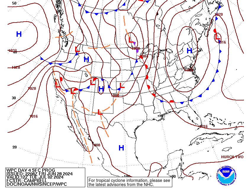
The main weather pattern for next week over our fine nation should
continue to feature a seemingly repeating pattern of active and
progressive northern stream shortwaves through the northern states
as a strong ridge meanders over the South, eventually building back
into the East and West Coasts. The best chance for heavy rains
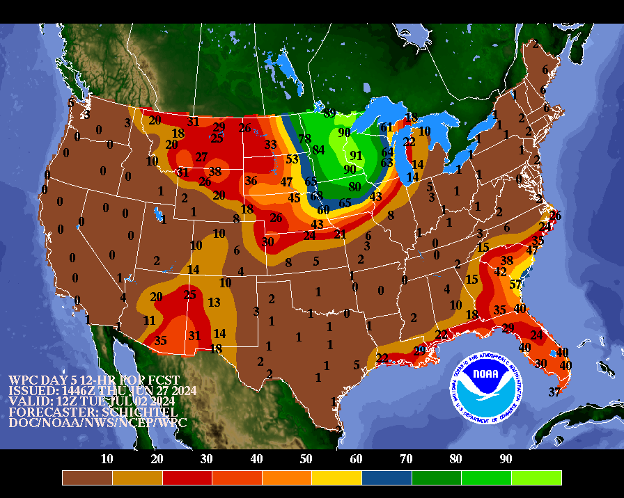
will be across the Upper Midwest Monday- Tuesday, lingering through
the holiday, and across the Southwest with a continuous moisture
feed around the western periphery of the ridge. Hazardous heat
threats will focus across much of the southern Plains to Southeast
most of the period, with some threat building into parts of the
Southwest and interior California by mid to later next week.
...Guidance/Predictability Assessment...
Model and ensemble forecast spread continues a trend of being
lower than normal through medium range time scales in a pattern
with above average predictability for mass fields and sensible
weather/hazards. The WPC product suite was primarily derived for
the Sunday-Tuesday timeframe from a composite blend of the 06 UTC
GFS and 00 UTC ECMWF along with the compatible 13 UTC National
Blend of Models (NBM) and WPC continuity. Opted to switch the blend
to best clustered guidance from the GFS/ECMWF and GEFS mean along
with the NBM for Wednesday and the Fourth amid slowly growing, but
still manageable timing variances. Newer 12 UTC guidance overall
remains in line. It should be noted that the latest ECMWF ensemble
mean was unavailable for this product cycle given computer issues.
...Weather/Hazards Highlights...
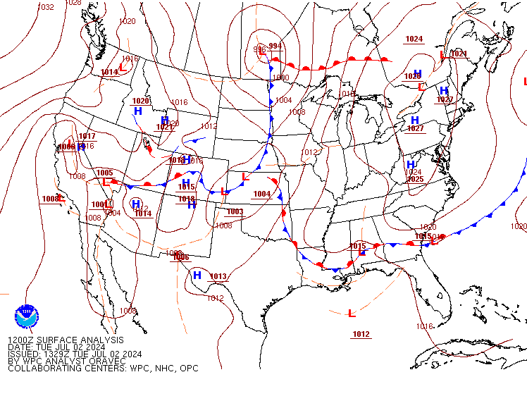
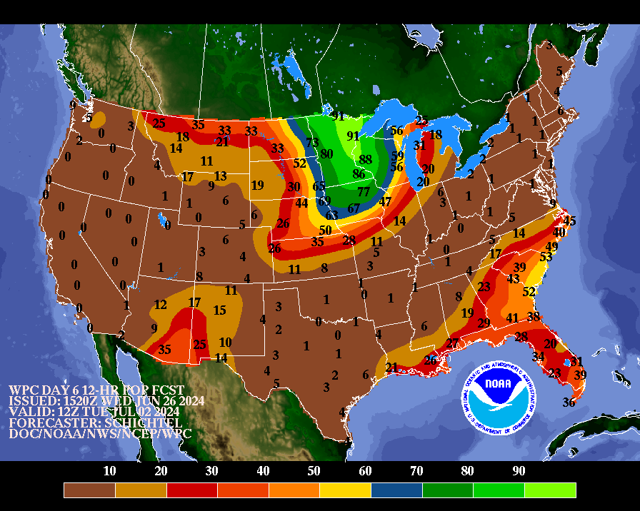
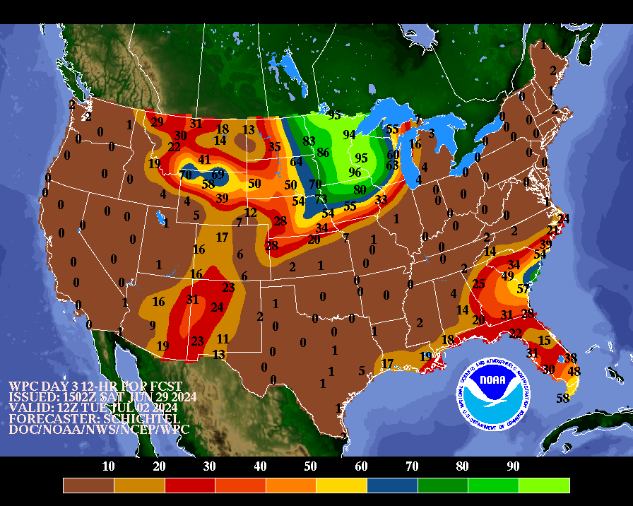
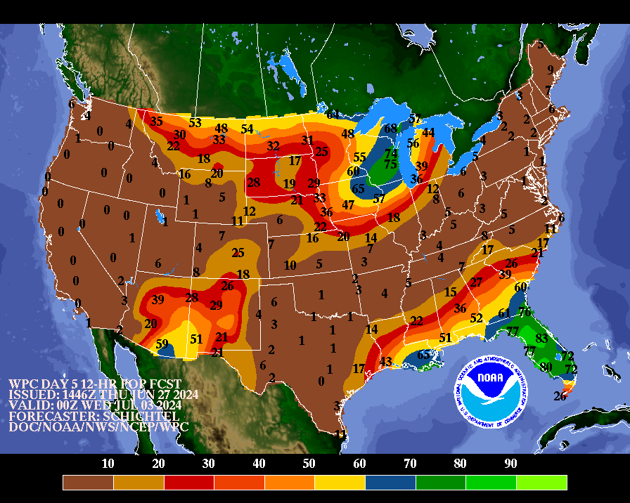
A weak surface low and slowing of a front exiting the East Coast
on Sunday could contribute to heavier rain potential across
portions of the Mid-Atlantic/Carolinas. Guidance has reasonably
trended
less progressive with this feature early next week up over the
western Atlantic. A marginal risk remains in place for the Day
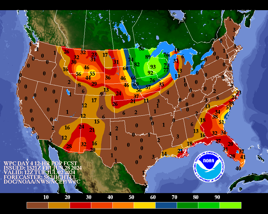
4/Sunday Excessive Rainfall Outlook. Showers and storms should also
focus along a boundary back into the central and northern Plains
ahead of the next system. Given some increased sensitivity and soil
moisture, a marginal risk also remains for the Day 4 ERO across
parts of the northern Plains as well. Heavy rain potential should
increase in coverage for the Upper Midwest and vicinity Monday into
Tuesday. There is uncertainty in the details, but a fairly broad
slight risk remains for the Day 5/Monday ERO, particularly given
recent and forecast heavy rain, which could cause new flooding
issues and exacerbate any ongoing flooding. The Storm Prediction
Center also indicates a threat for severe weather to monitor. Ample
showers and storms that offer local heavy downpours with runoff
issue potential look to continue southward and eastward as well
into the Mid- Mississippi Valley/Central Plains and Great
Lakes/Ohio Valley Wednesday into Independence Day.
Monsoonal type flow into the Southwest will continue the daily
threat for showers and storms through much of the period. Marginal
risks remain in place across parts of Arizona and New Mexico for
the days 4 and 5 ERO, with potential for upgrades to a slight in
subsequent updates depending on short range rainfall. This pattern
is likely to persist into next Tuesday/Wednesday as well given the
lingering and deepened moisture channel on the upper ridge western
periphery. Daily precipitation chances will also persist in the
Southest/Florida as above normal moisture lingers for the region.
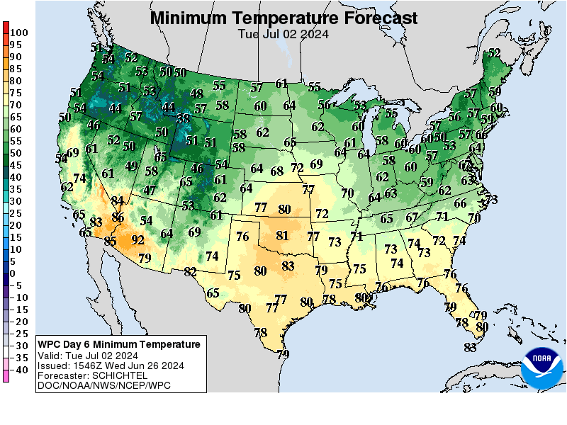
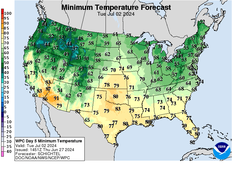
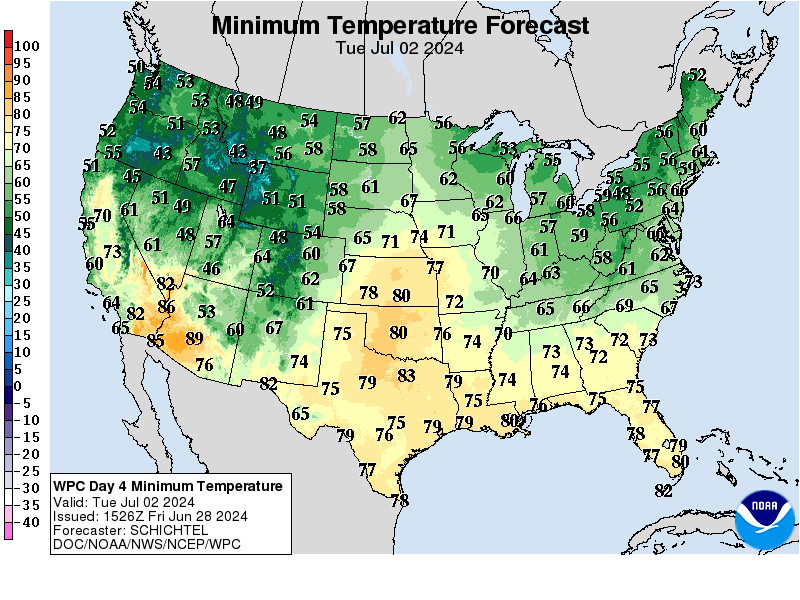
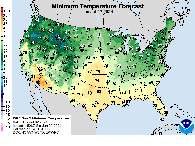
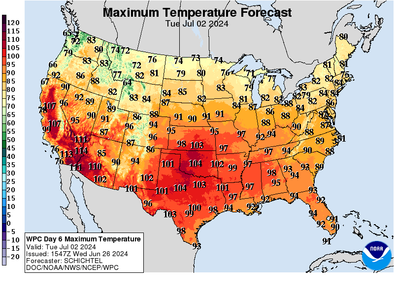
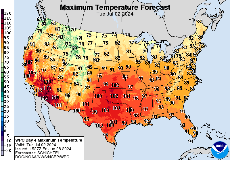
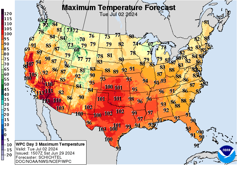
Hazardous heat potential will focus across the South and Southeast
underneath a persistent upper ridge through the weekend into next
week. Several days of above normal temperatures (both daytime highs
and nighttime lows) are forecast from the Central and Southern
Plains eastwards, expanding with time into parts of the Midwest and
Mid-Atlantic by mid next week. The northern tier states should be
near or below normal with system passages, and some above normal
temperatures/heat may build back into parts of California towards
the end of the period.
Santorelli/Schichtel
Additional 3-7 Day Hazard information can be found on the WPC
medium
range hazards outlook chart at:
https://www.wpc.ncep.noaa.gov/threats/threats.php
WPC medium range 500mb heights, surface systems, weather grids,
quantitative precipitation forecast (QPF), excessive rainfall
outlook (ERO), winter weather outlook (WWO) probabilities, heat
indices, and Key Messages can be accessed from:
https://www.wpc.ncep.noaa.gov/medr/5dayfcst500_wbg.gif
https://www.wpc.ncep.noaa.gov/medr/5dayfcst_wbg_conus.gif
https://www.wpc.ncep.noaa.gov/5km_grids/5km_gridsbody.html
https://www.wpc.ncep.noaa.gov/qpf/day4-7.shtml
https://www.wpc.ncep.noaa.gov/#page=ero
https://www.wpc.ncep.noaa.gov/wwd/pwpf_d47/pwpf_medr.php?day=4
https://www.wpc.ncep.noaa.gov/heat_index.shtml
https://www.wpc.ncep.noaa.gov/#page=ovw


