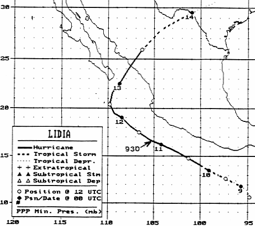
A tropical wave moved off the coast of Africa on August 24th. It moved westward with no development,
bringing showers to the southern Windward Islands on September 1st. The wave tried to develop thunderstorm
activity over the southwest Caribbean Sea on the 3rd and 4th before moving into Central America. Thunderstorm
activity increased in organization after emerging into the eastern tropical Pacific, with a tropical depression forming
on the morning of the 8th. Strengthening into a tropical storm, the system paralleled the Mexican coastline. Lidia
became a hurricane during the night of the 9th, and a category 4 hurricane by the night of the 10th. A mid to upper
level low began to cause the strong hurricane to recurve on the 12th towards mainland Mexico. Weakening as it
approached the coast, Lidia struck near Culican as a category 2 hurricane on the 13th, while continuing to accelerate
northeast. The system weakened quickly thereafter, becoming a tropical storm over north-central Mexico and a
tropical depression as it crossed the Rio Grande into the United States. By the morning of the 14th, Lidia linked
up with a frontal zone, becoming a weak frontal wave. Below is its track, supplied by the National Hurricane
Center.
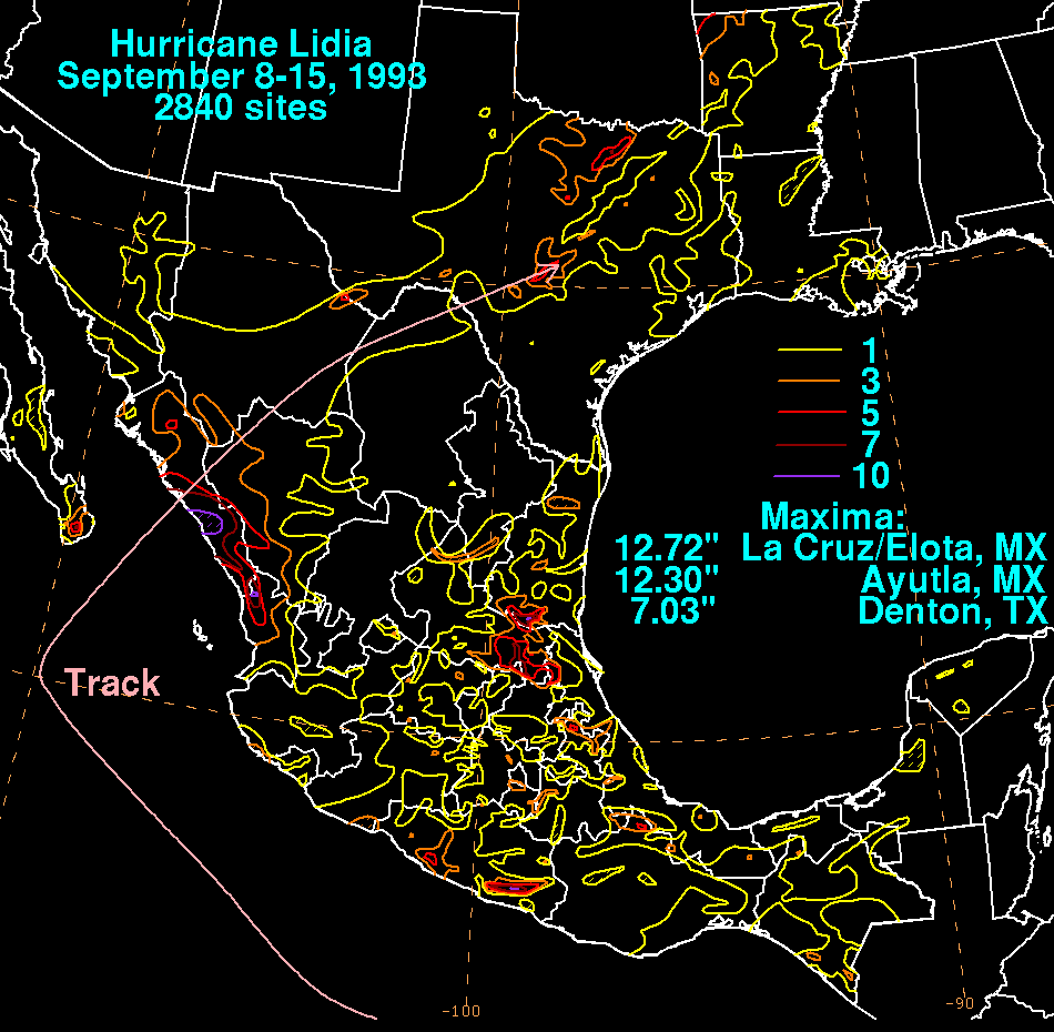
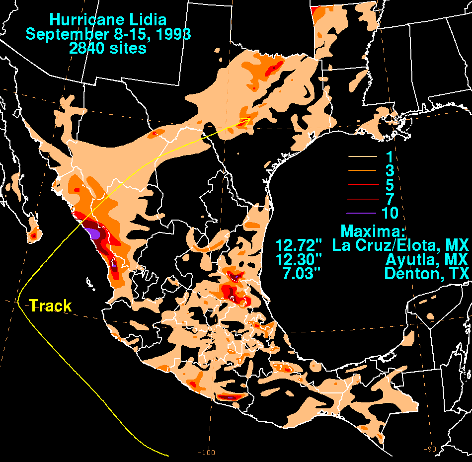
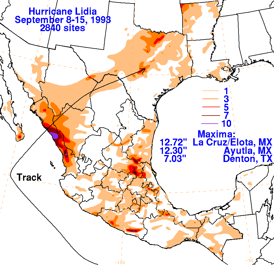
The graphics below show the storm total rainfall for Lidia, which used information from the Comision del
Agua, which is the parent agency of Mexico's National Weather Service, and the National Climatic Data Center
in Asheville, North Carolina.
 |
 |
 |