Ivan was a classical long-lived Cape Verde hurricane that made three landfalls along the United
States coast and reached category 5 strength three times. Ivan developed from a vigorour tropical
wave that moved off the west coast of Africa on August 31st. The system quickly strengthened and
became a tropical depression on September 2nd, a tropical storm on the 3rd, a hurricane on the 5th,
and a major hurricane later that day. Ivan moved westward for the next several days and passed
over the southern Windward Islands where it caused considerable damage and loss of life, especially
on Granada. Ivan then moved west-northwestward across the southern Caribbean Sea passing just
north of Venezuela and the Netherlands Antilles. Ivan reach category 5 strength while over the
central Caribbean Sea early on the 9th as it moved towards Jamaica. As Ivan approached the island,
it weakened to category 4 intensity as it moved just south of the country.
After passing Jamaica, Ivan briefly regained category 5 strength on the 11th when the hurricane was
south of the Cayman Islands. Ivan inflicted considerable damage and loss of life on Grand Cayman
Island as the hurricane veered towards western Cuba. Its intensity fluctuated slightly on the 12th
and 13th. Ivan's small eye moved through the Yucatan channel, missing Cuba. For the next three days,
Ivan moved northwest over the eastern and central Gulf of Mexico before striking Gulf Shores, Alabama
at category 3 strength early on the 16th.
Ivan gradually weakened unleashing heavy rains upon the southern Appalachians as it moved towards the
Mid-Atlantic states. This powerpoint presentation shows the synoptic pattern Ivan was embedded within
while it travelled through the Southeast and Mid-Atlantic States, provided courtesy of Jared Klein of
SUNY-Albany.
On the 19th, Ivan emerged into the western Atlantic ocean as an extratropical cyclone. Its surface circulation
turned south and southwest towards Florida, moving through the southern peninsula back into the Gulf of
Mexico on the 21st. The cyclone became a tropical storm once more on the 23rd, making landfall in the United
States for a third time across extreme southwest Louisiana on the 24th before dissipating across eastern Texas.
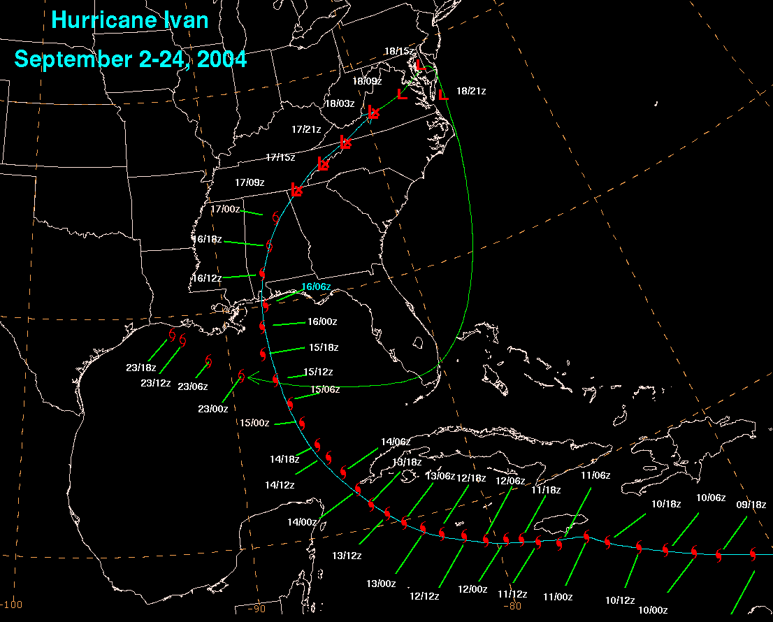
Below is a track of the cyclone, created from HPC and TPC advisories.

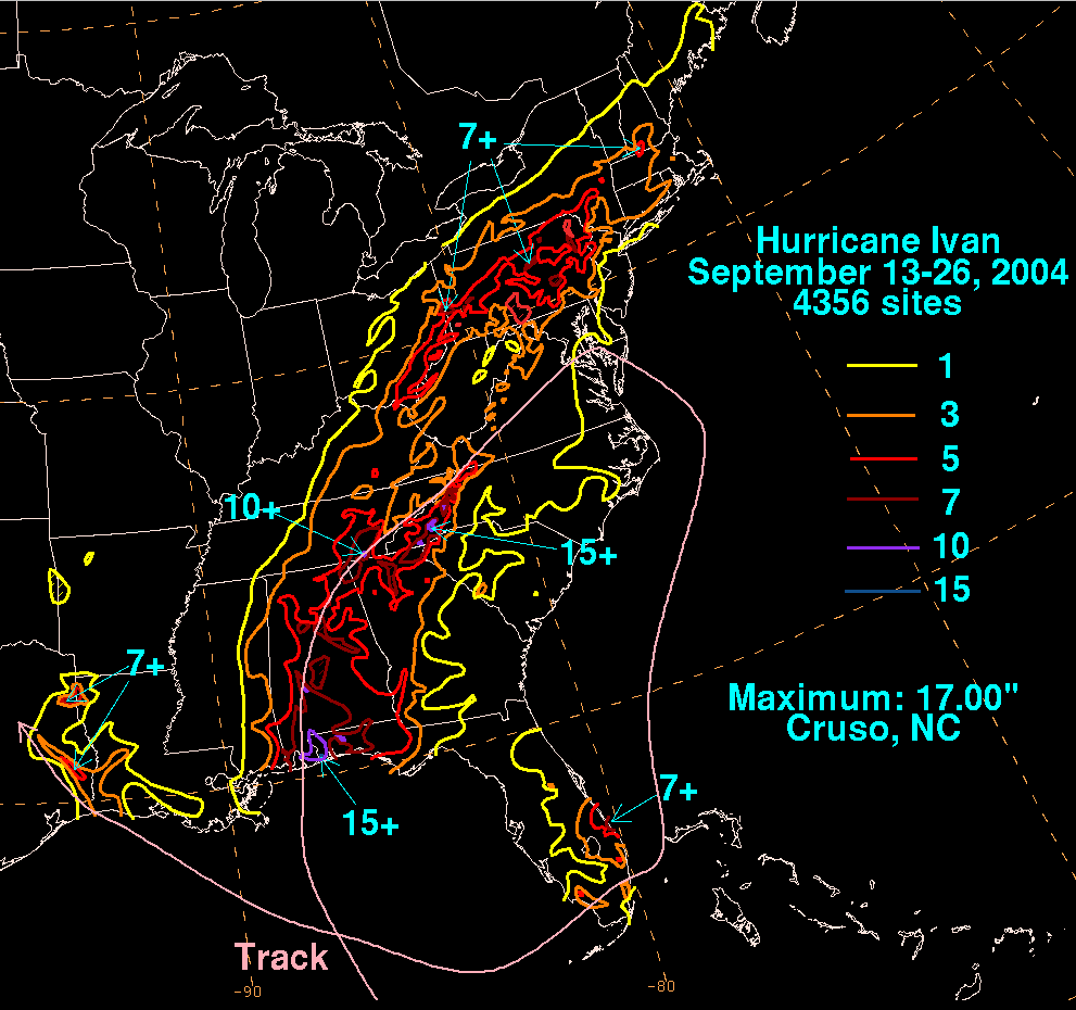
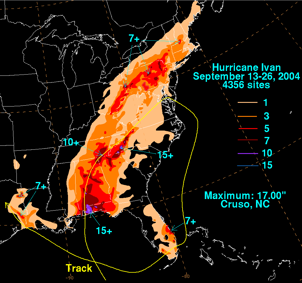
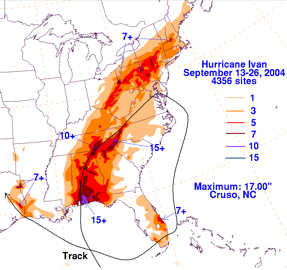
The storm total rainfall maps below were constructed using data
from
data
provided from NWS
River Forecast Centers, as well as additional
reports received by the
National Hurricane Center.
 |
 |
 |
Below are the calendar for Daily Precipitation Maps.
Note
that
the 24-hour periods end
at 12z that morning. In the 24 period ending the morning of the
20th, Ivan was offshore
the Southeast and produced no rainfall.