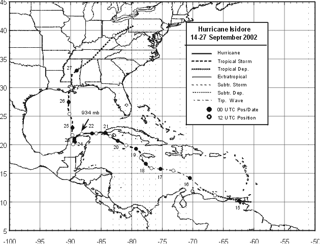
A tropical wave moved off the coast of Africa on 9 September
accompanied
by a large area of
thunderstorms. The convective activity decreased significantly as the
system moved toward the
west-southwest during the next few days. As the wave approached 50
West, the shower activity
began to increase and an upper-level anticyclone became evident over
the system. Shortly after
noon on the 14th, there was enough convection and rotation to classify
the system as a tropical
depression as it approached Trinidad and the northern coast of
Venezuela.
The depression moved
west-northwestward and its development was halted by its interaction
with land. Around noon on
the 15th, the system had degenerated into a tropical wave in the
eastern
Caribbean Sea. However, as
the wave entered the western Caribbean Sea, it redeveloped a closed
circulation and regained tropical
depression status on the morning of the 17th, about 120 n mi south
of Kingston, Jamaica.
It strengthened into Tropical Storm Isidore after midnight on the
18th,
and, embedded within a weak
steering current, the tropical cyclone moved very slowly toward the
northwest, passing just west of
Jamaica. Isidore then moved very slowly toward the west-northwest
across
the Cayman Islands and
became a hurricane shortly after noon on the 19th. Its winds reached
105 mph after midnight on the 20th
as it was nearing the southwest coast of the Isle of Youth, Cuba.
Although
the minimum pressure
continued to drop, Isidore's winds decreased a little bit and the
hurricane
made landfall near Cabo Frances
in western Cuba during the afternoon of the 20th. The hurricane then
moved west and southwestward
toward the Yucatan Peninsula and restrengthened, reaching its maximum
intensity of 125 mph after
noon on the 21st.
Isidore meandered for 24 to 36 hours over northern Yucatan and
weakened
to a minimal tropical storm. It
finally moved northward over the Gulf of Mexico where the circulation
expanded but the cyclone never
redeveloped an inner core of strong winds due to its extremely warm
core. Isidore made landfall with winds
of 65 mph just west of Grand Isle, Louisiana at 0600 UTC 26 September.
Once it moved inland, Isidore
weakened to a tropical depression and moved north-northeastward across
the southeastern United
States, producing torrential rains. It became an extratropical storm
over southwestern Pennsylvania at
1800 UTC 27 September, and was then absorbed into a frontal zone.
Below is the track of Isidore,
furnished by the National Hurricane Center.
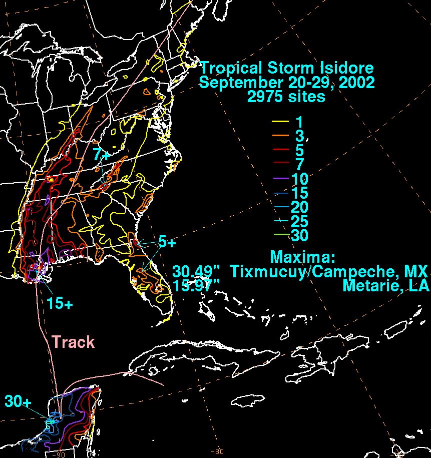
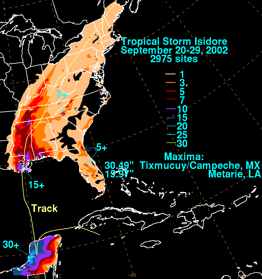
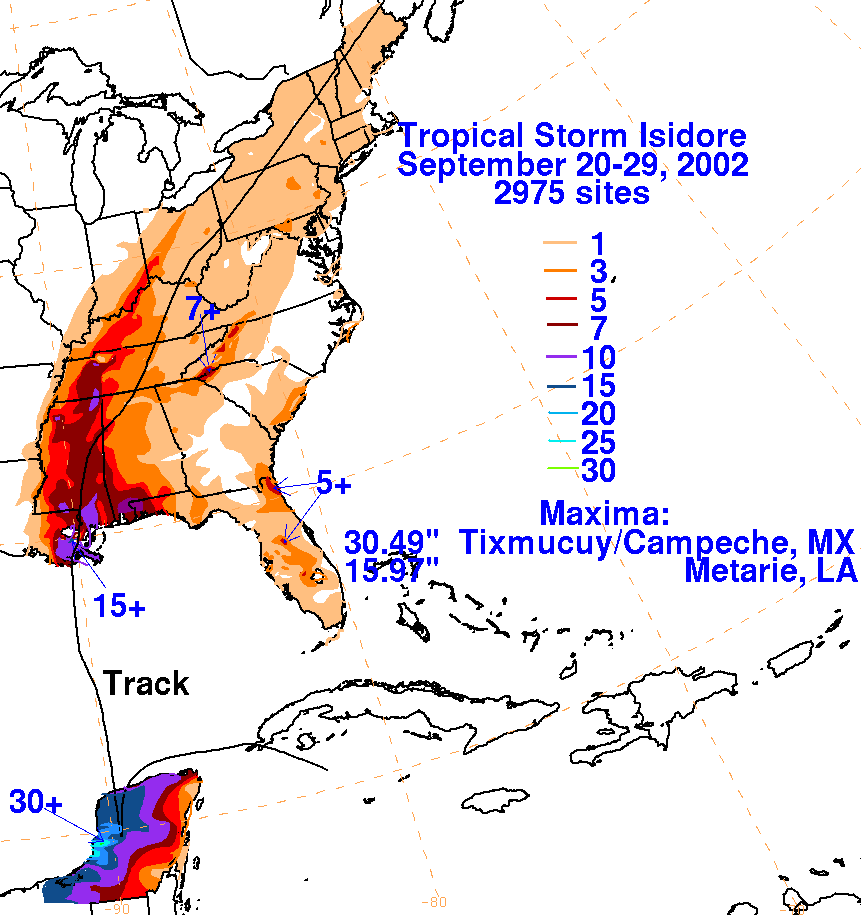
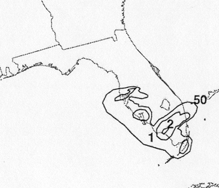
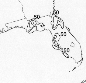
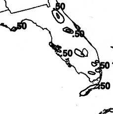
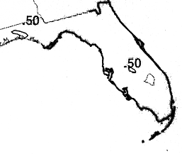
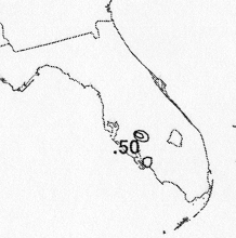
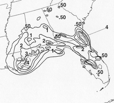
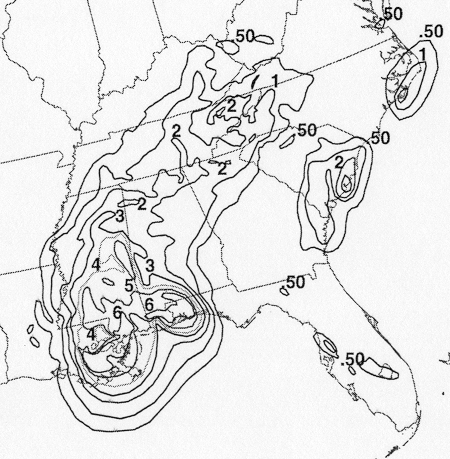
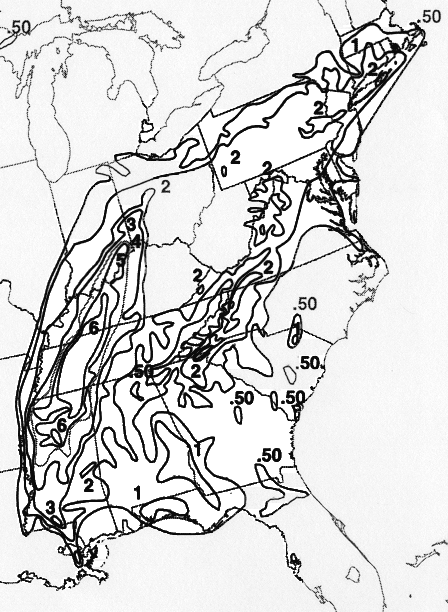
The storm total rainfall maps below were constructed using data from
the
National Climatic Data Center,
the Louisiana Agriclimatic Network, the Southwest Florida Water
Management District, and the
Comision Nacional del Agua, parent agency of Mexico's National Weather
Service.
 |
 |
 |
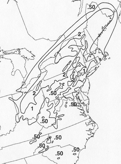
Below are the calendar for Daily Precipitation Maps. Note that
the 24-hour periods end
at 12z that morning.