The wave that spawned Georges moved off the coast of Africa late on
September 13th. As it was
moving south of the Cape Verde Islands on the 15th, ship reports
indicated
a closed circulation,
showing the presence of a tropical depression. It evolved into
a tropical storm on the 16th while
located in the tropical Atlantic. Steady intensification ensued,
and George became a hurricane on
the 17th midway across the Atlantic. Georges ultimately peaked
as a strong category four hurricane
around midnight on the 19th/20th, while approaching the Lesser
Antilles.
It interacted with an upper
low and islands of the northeast Caribbean, weakening the system to
a category three hurricane as
it made landfall in Puerto Rico around 6 p.m. on the 21st. After
producing over 20 inches of rain
over the island, it moved across the remainder of the Greater
Antilles...the
first time since Claudette
in 1979 a tropical cyclone was moved along this track. The maps
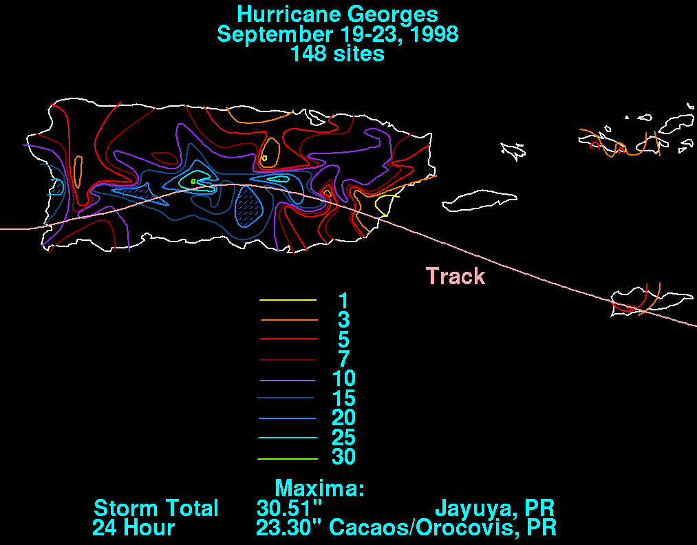
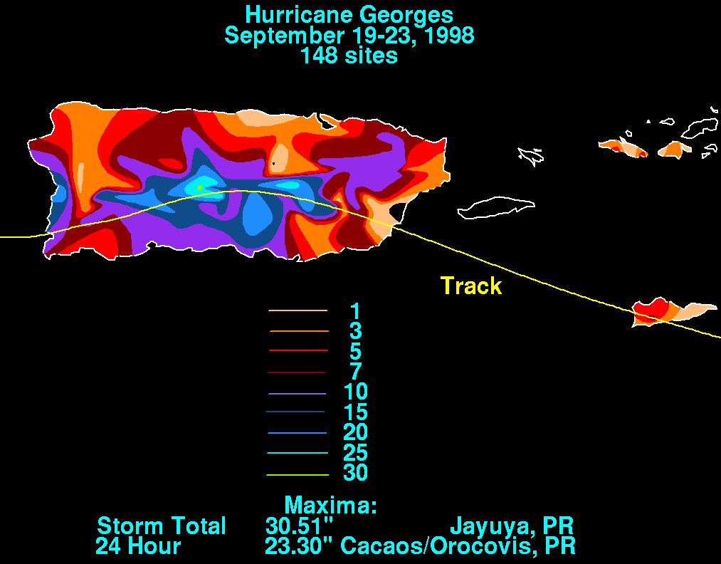
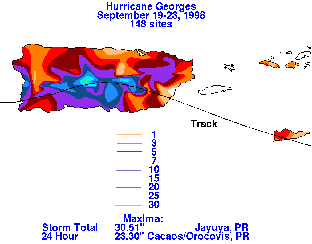
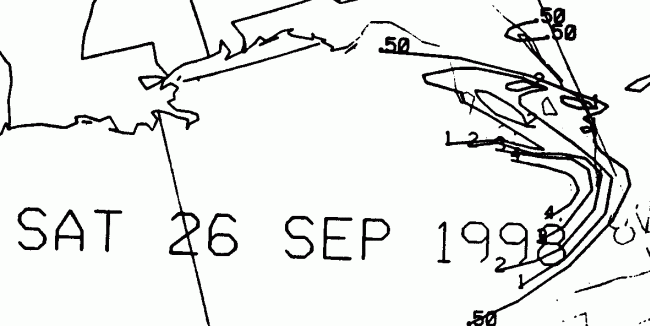
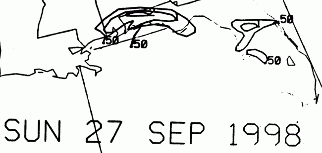
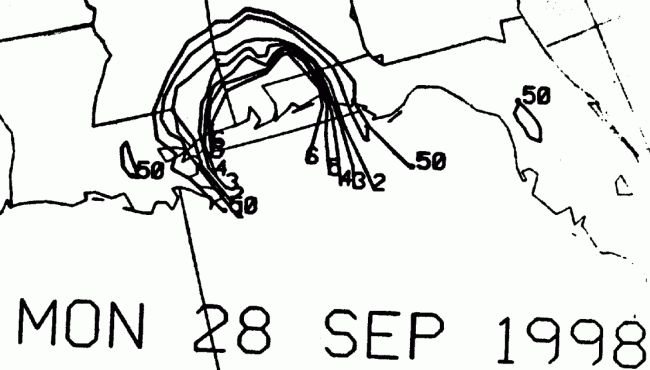
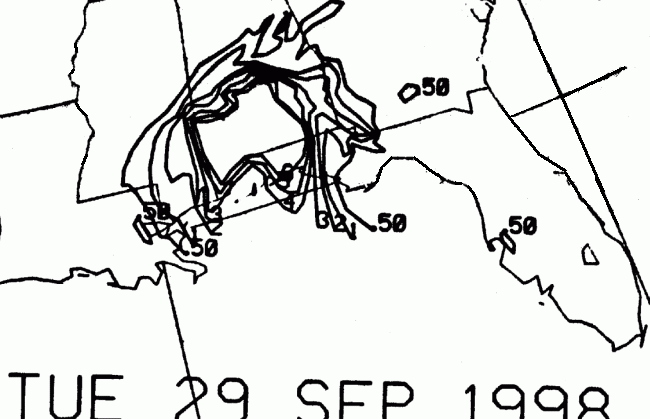
below show the rainfall distribution
of Georges for the northeast Caribbean, using data provided by the
Southeast River Forecast Center
in
Peachtree City, GA and the National Climatic Data Center in Asheville,
NC.
 |
 |
 |
After its encounter with Haiti and the Dominican Republic, Georges
weakened
to a category one
hurricane. As it made a series of landfalls...7 in all...its
strength fluctuated as it moved from land to
water. It fully emerged back over open water in the Florida
Straits
on the 25th, restrengthening
to category two intensity...a strength that would not waver until its
final landfall near Biloxi on the
morning of the 29th. It edged to the east with time, moving into
the Florida panhandle as a tropical
storm late on the 29th. After moving through the panhandle,
Georges
began its transition into an
extratropical low, which moved east-northeastward into the Atlantic
on the 1st. Below is the track
of this cyclone, provided by the National Hurricane Center.

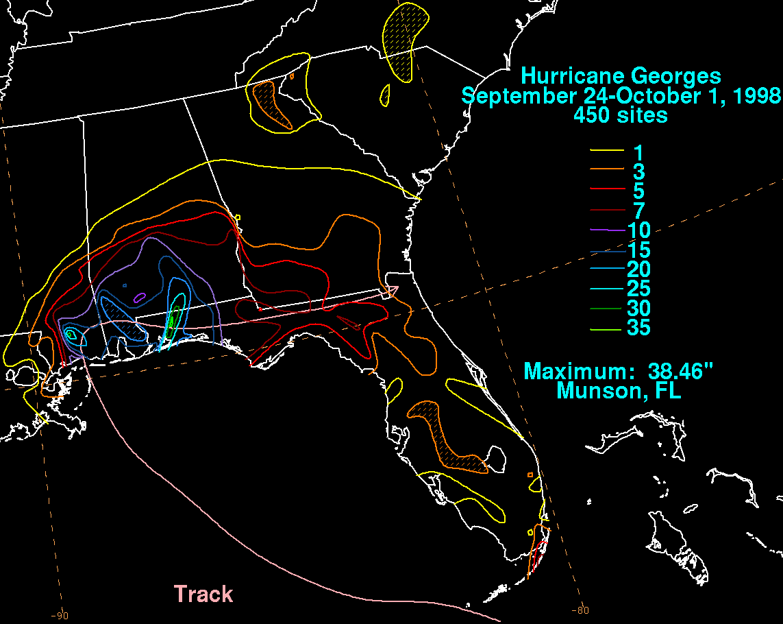
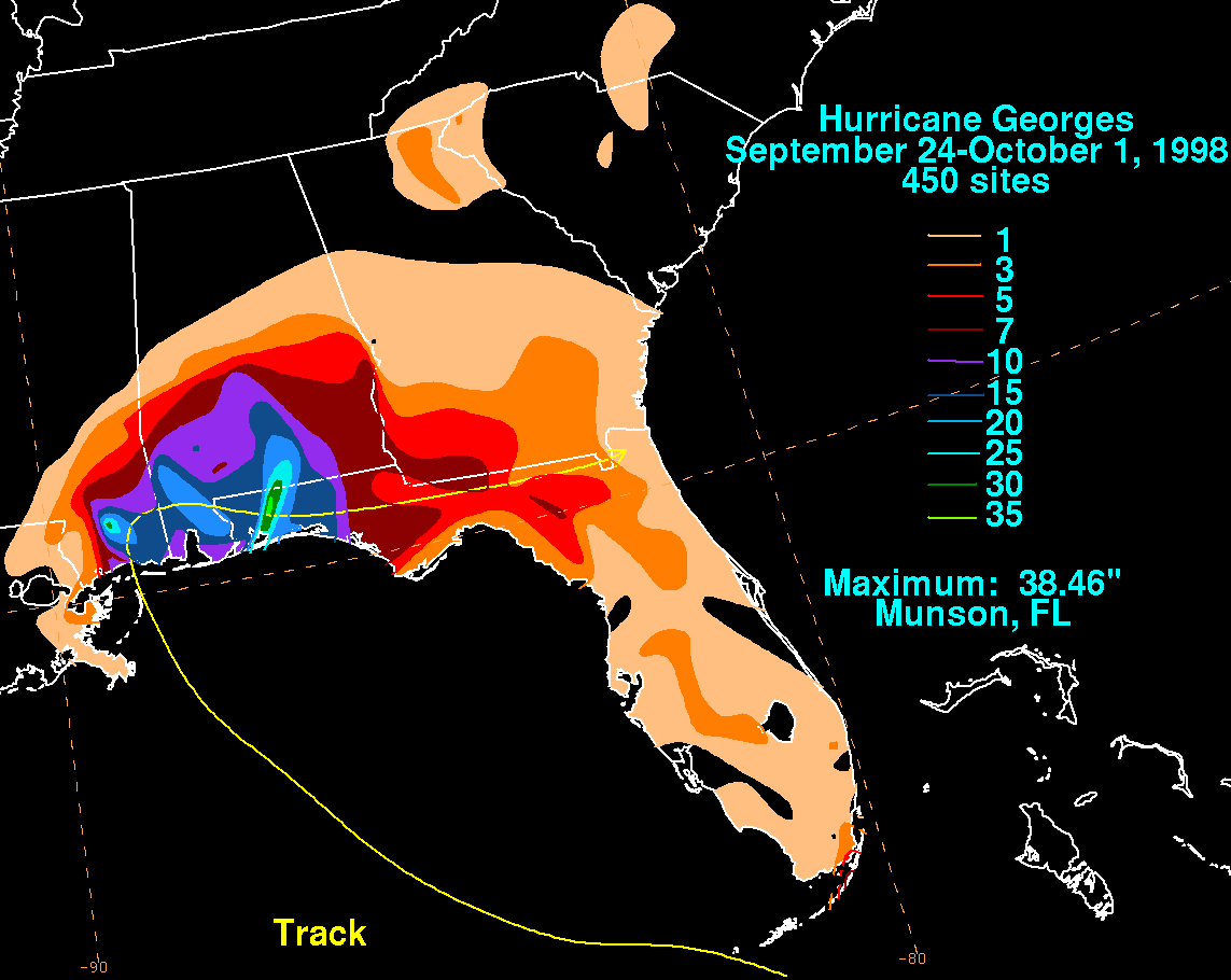
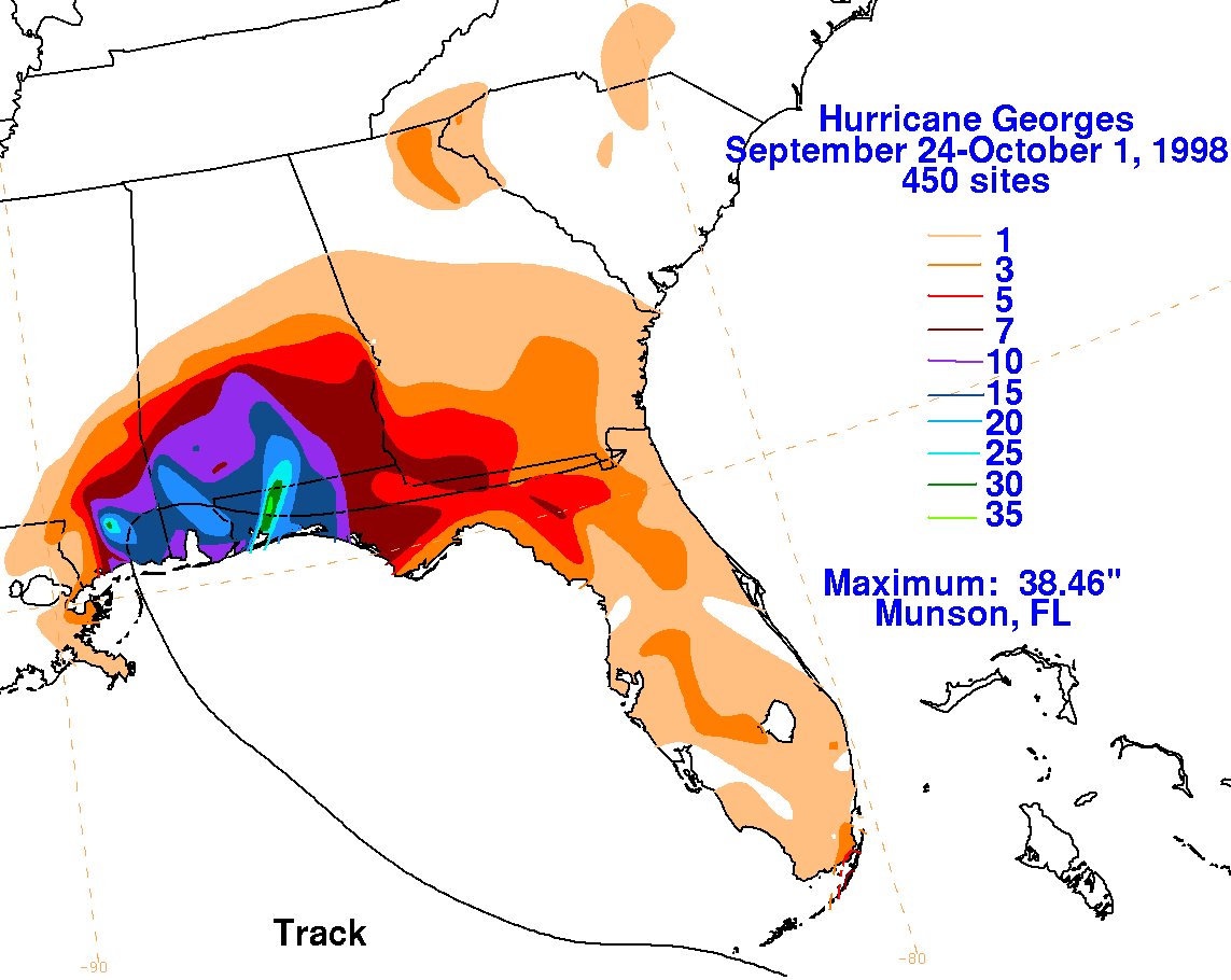
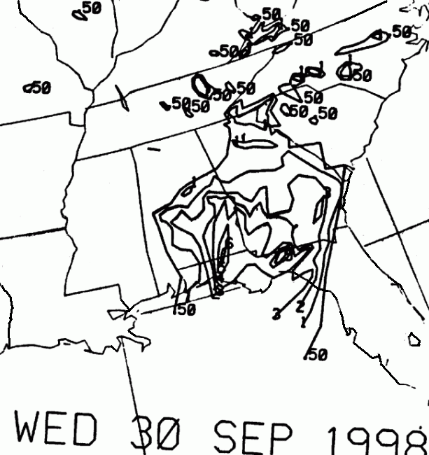
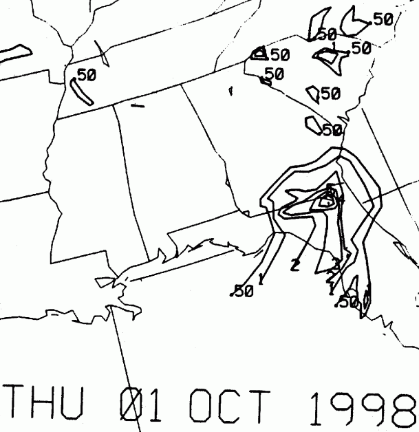
On the graphic below is the storm total rainfall for Georges.
Note the maxima across the southern Mississippi
and the western Florida panhandle, where the storm originally made
landfall and near where
it was centered
early the next morning, respectively.
 |
 |
 |
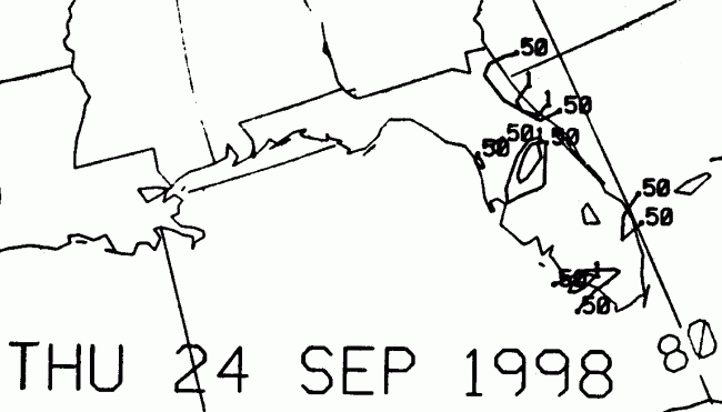
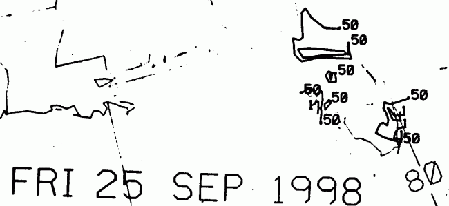
Below is the calendar for Daily Precipitation Maps. Note that
the 24-hour periods end
at 12z that morning.