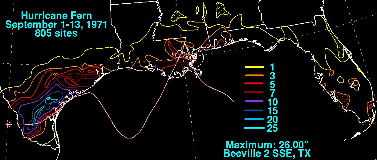
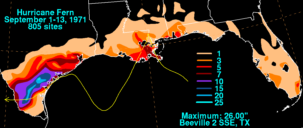
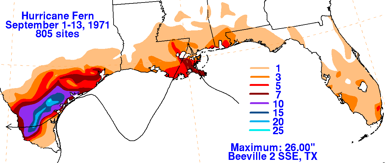
Fern developed from a tropical wave which moved northwest out of the Caribbean Sea on September 1st. A
closed mid-level low formed over Florida on the 2nd, with a tropical depression forming the next day as it
developed a surface circulation. It moved northwest into Louisiana before a blocking ridge in the central
United States forced the system back into the Gulf of Mexico. Moving southwest, Ferm became a tropical
storm on the 7th and a hurricane on the 8th. It became stationary for a bit before a mid-level trough moved
northwest towards the Texas coast. After a ridge built in behind the trough, Fern resumed a west-southwest
track that evenutally brought it inland near Freeport on the 10th. It dropped to tropical depression strength as
the center moved into Mexico. Numerous towns were seriously inundated from the heavy rains as the lower
Nueces, Frio, Lavaca, Navidad, Guadeloupe, Mission, and Aransas rivers experienced a major flood. Below
is the storm total rainfall graphic and track. Rainfall data was provided by the National Climatic Data Center
in Asheville, North Carolina.
 |
 |
 |