A broad low pressure area formed near the Yucatan channel. The system organized as it moved through
the central and western Gulf of Mexico, becoming a tropical depression and then tropical storm as it headed
towards southern Texas. The system moved inland and weakened to a tropical depression. As is typical
for a non-sheared tropical cyclone, thunderstorms developed near the center each night. Early on the
morning of the 19th, a shortwave moved by to its north which significantly enhanced divergence over
the tropical depression and led to significant strengthening. Beginning at 1 am CDT, maximum sustained
winds reached tropical storm force, peaking at 50 mph between 2 and 3 am with gusts near 80 mph as the
system briefly formed an eye feature. The central pressure of the depression dipped from 1007 hpa
to at least 1000 hpa per observations from the Oklahoma mesonet.
After sunrise, the shortwave that led to the deepening moved by to the east and began to shear the
cyclone from the northwest. The system weakened back into a tropical depression by noon and its
low level circulation was gone by 4 pm CDT. Its remnant mid level circulation led to one last burst of
very heavy rainfall over Missouri. Thereafter, the shortwave accelerated eastward and its associated
rainfall dropped off significantly.
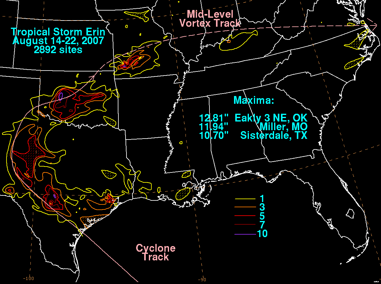
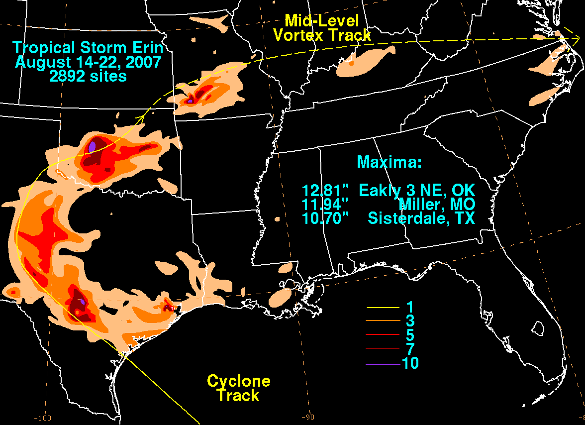
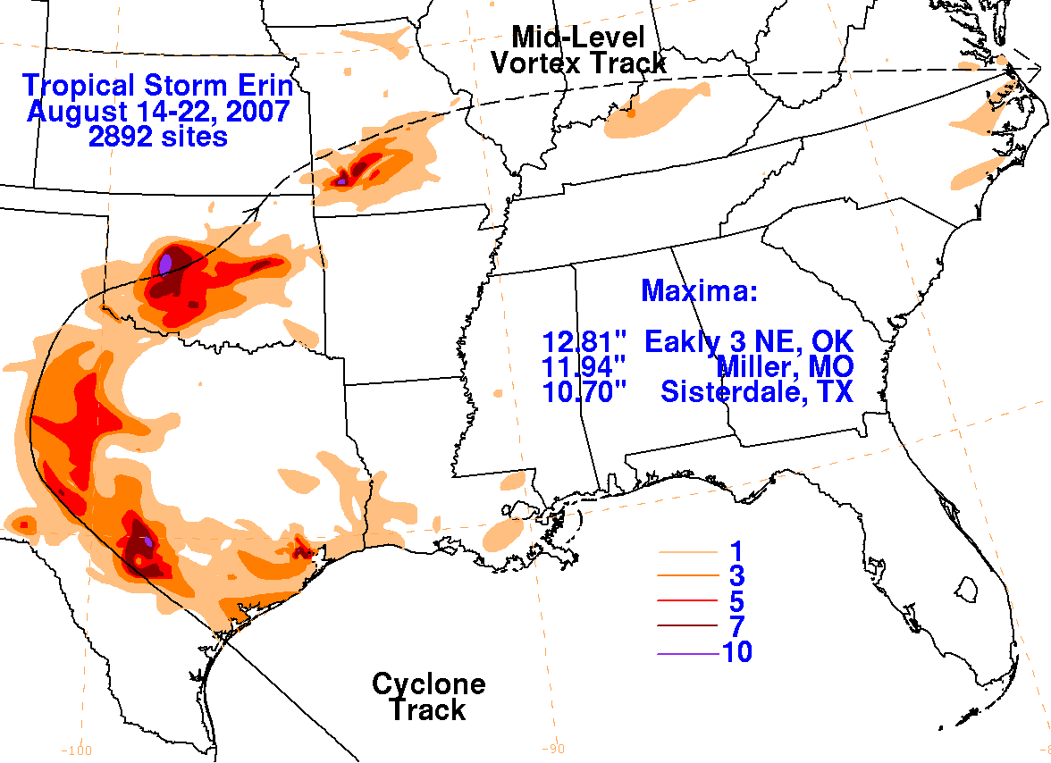
Below are the storm total graphics for Erin. The first three were prepared with rain guage data from the NWS
River Forecast Centers, CoCoRAHS, with one observation from the Storm Prediction Center in Norman, Oklahoma.
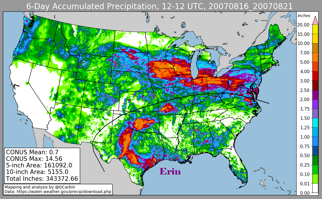
The fourth image uses radar-derived information.
 |
 |
 |
 |