A distubance moved off the west coast of Africa on September 6th with a notable cyclonic circulation.
The system moved west at 15 mph across the tropical Atlantic over the following six days. Slow organization
ensued, and ship reports early on the 13th confirmed the presence of a tropical depression roughly 500 miles
east of the Lesser Antilles. Slow intensification continued since its upper anticyclone was not well-defined,
Eloise became a tropical storm early on the 16th. Soon afterwards, upper level conditions became ideal and
Eloise rapidly developed into a hurricane before striking the northeast Dominican Republic late that day.
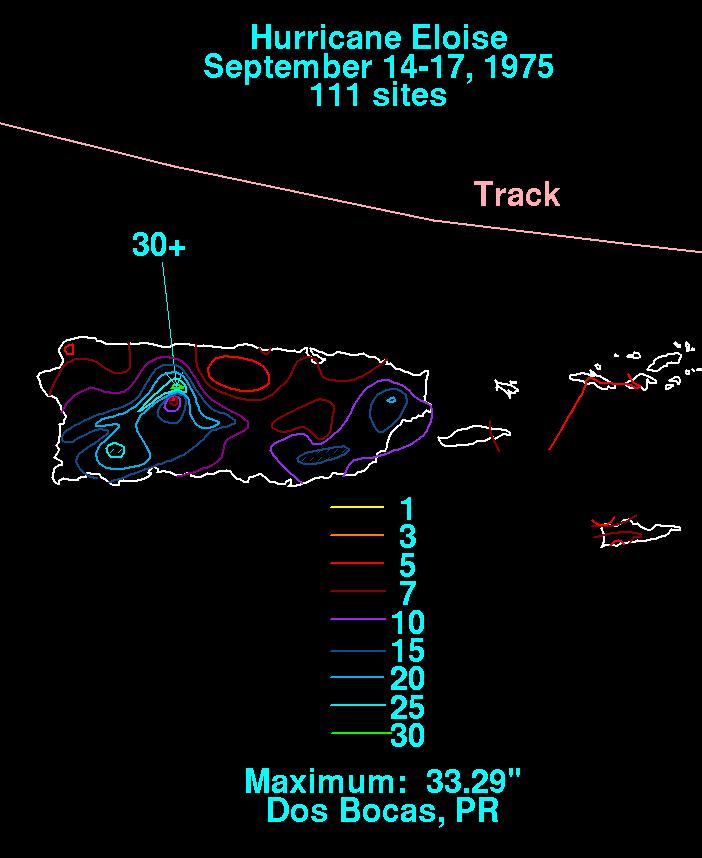
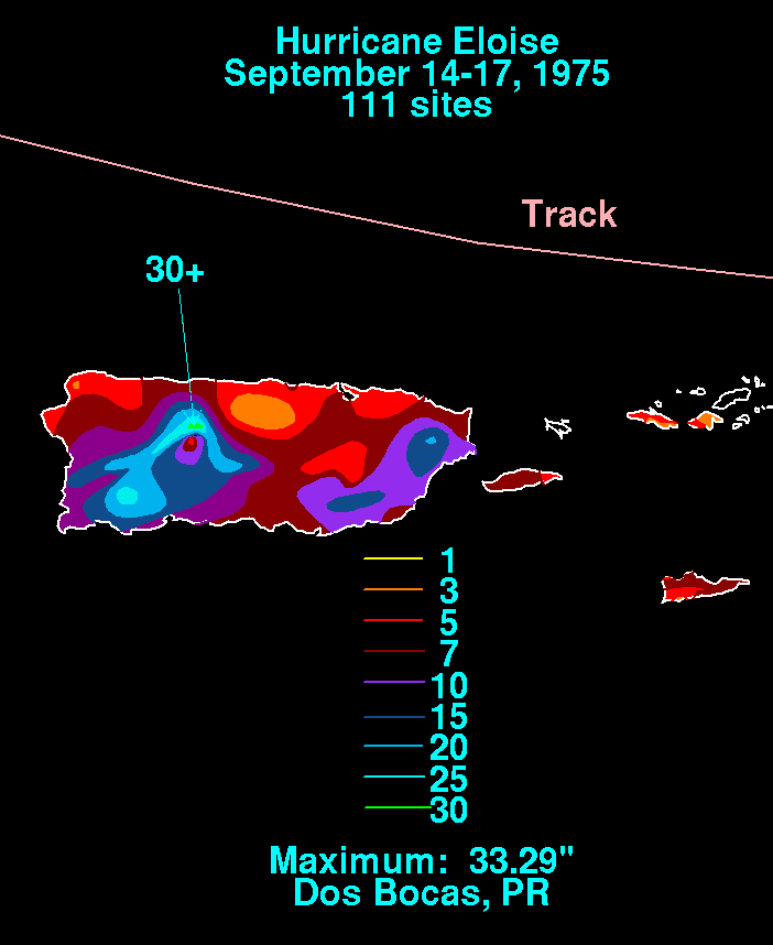
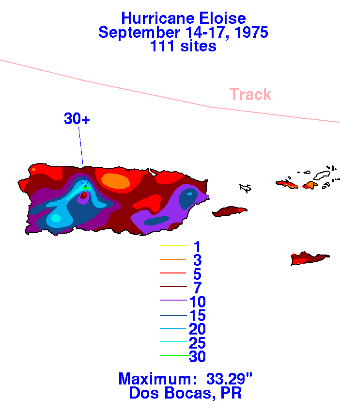
Below is the storm total rainfall graphic for Puerto Rico and the U.S. Virgin Islands, using data provided
by the National Climatic Data Center in Asheville, North Carolina.
 |
 |
 |
The system moved across northern Hispaniola, across southern Cuba, and then into the northwest Caribbean
Sea by the 19th as a weak tropical storm. The circulation slowly reorganized from its encounter with high
terrain in the Greater Antilles. As the cyclone moved through the Yucatan channel, Eloise strengthened.
It regained hurricane force on the 22nd by the time it reached the central Gulf of Mexico about 300 miles
south of New Orleans.
Strengthening continued until landfall midway between Fort Walton Beach and Panama City at 8 a.m.
on the 23rd. As it moved inland and encountered cooler and drier air, the storm weakened, becoming
a tropical storm around noon and a tropical depression that evening. By the morning of the 24th, the
cyclone has become a frontal wave as it moved into the southwest tip of Virginia. A deep cyclone
formed to its west, which led to substantial rains ahead of the weak frontal wave formerly associated
with Eloise. By the morning of the 27th, this low had moved into Atlantic Canada.
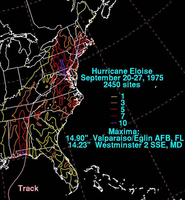
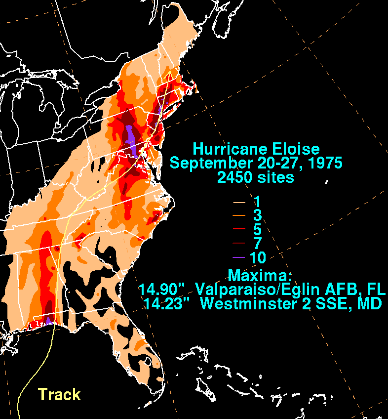
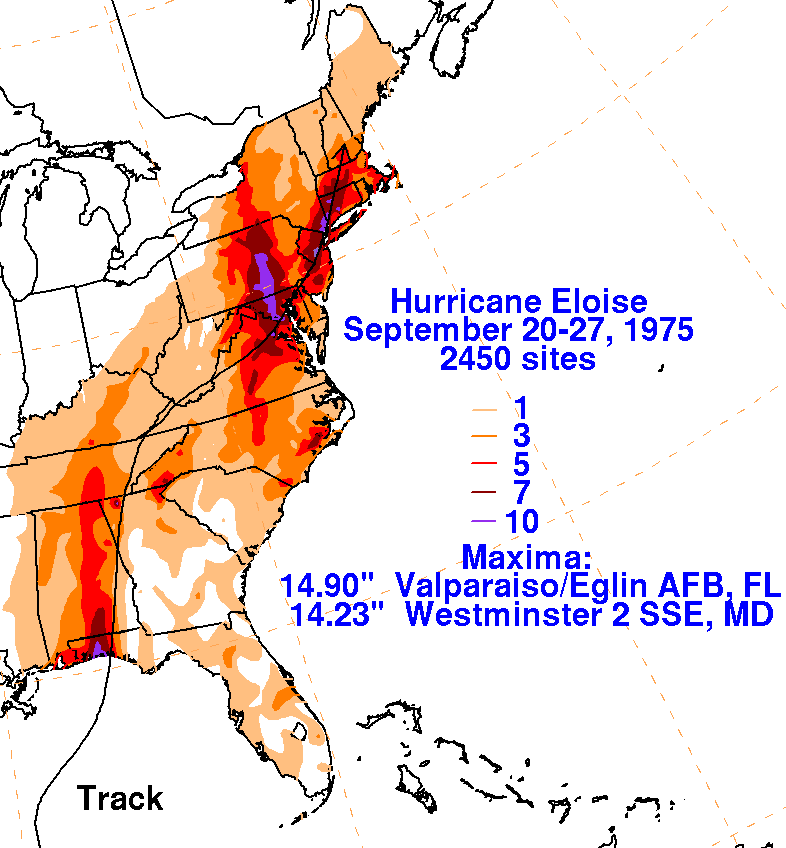
The graphics below show the storm total rainfall for both Eloise and its remnant frontal wave,
using data provided by the National Climatic Data Center in Asheville, North Carolina.
 |
 |
 |