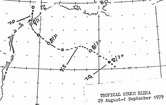
A weak tropical wave passed through Florida on August 27th.
The wave slowly developed, with a low level
circulation forming on the morning of the 29th, and presence of the
tropical depression was confirmed that
evening by reconnasissance aircraft. The system slowly developed
as it moved west-northwest, becoming a
tropical storm by the afternoon of the 30th. The system turned
gradually to the north, moving inland near
Matagorda on the morning of the 1st. By the morning of the 2nd,
the system lost its low level circulation,
dissipating as a tropical depression. Over the next four days,
Elena's remnants drifted just inland of the middle
Texas coast, trapped in a col in the upper level flow between two
mid-level ridges, before dissipating on the
6th. Below
is a track of the storm, created by the National Hurricane Center.
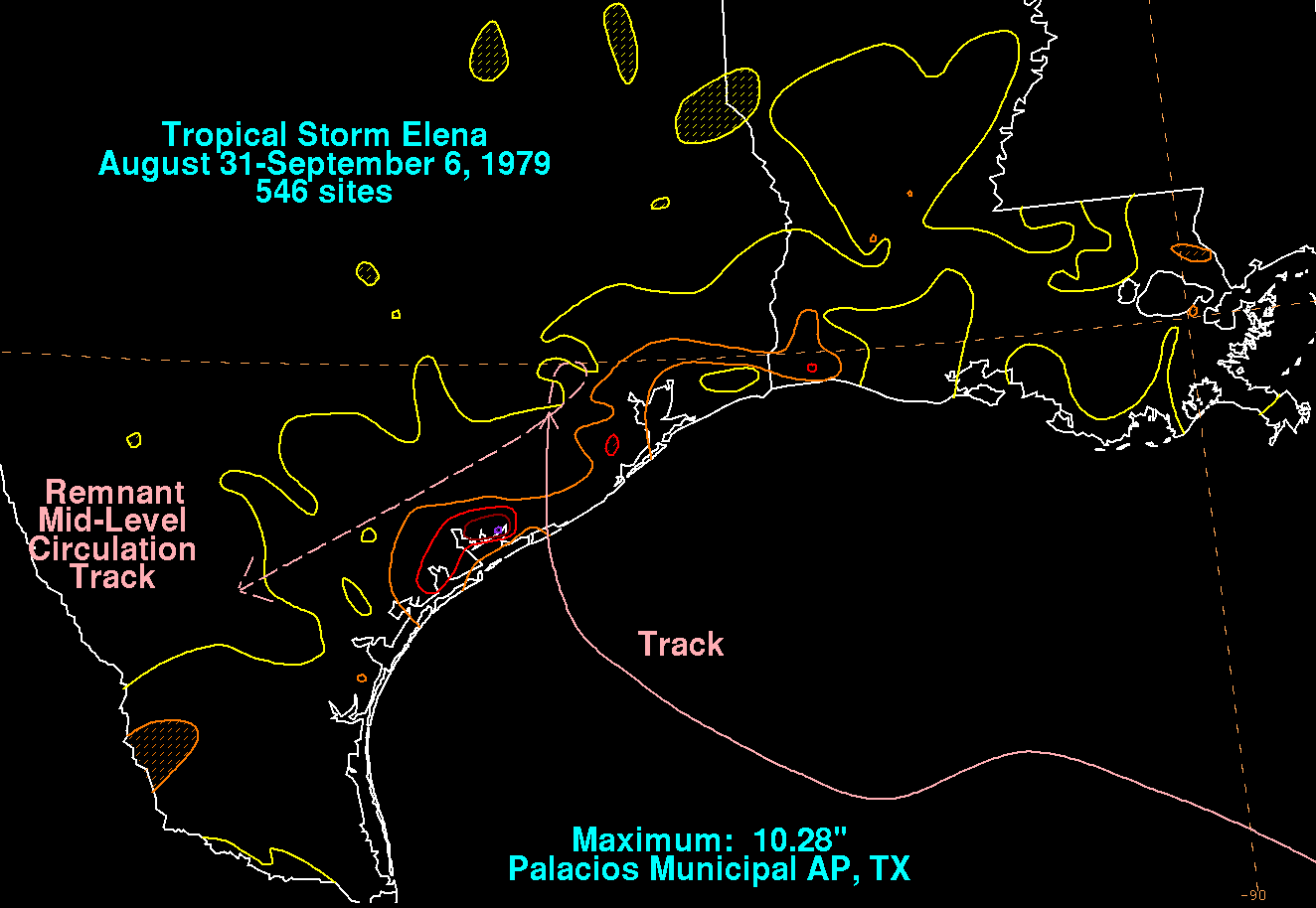
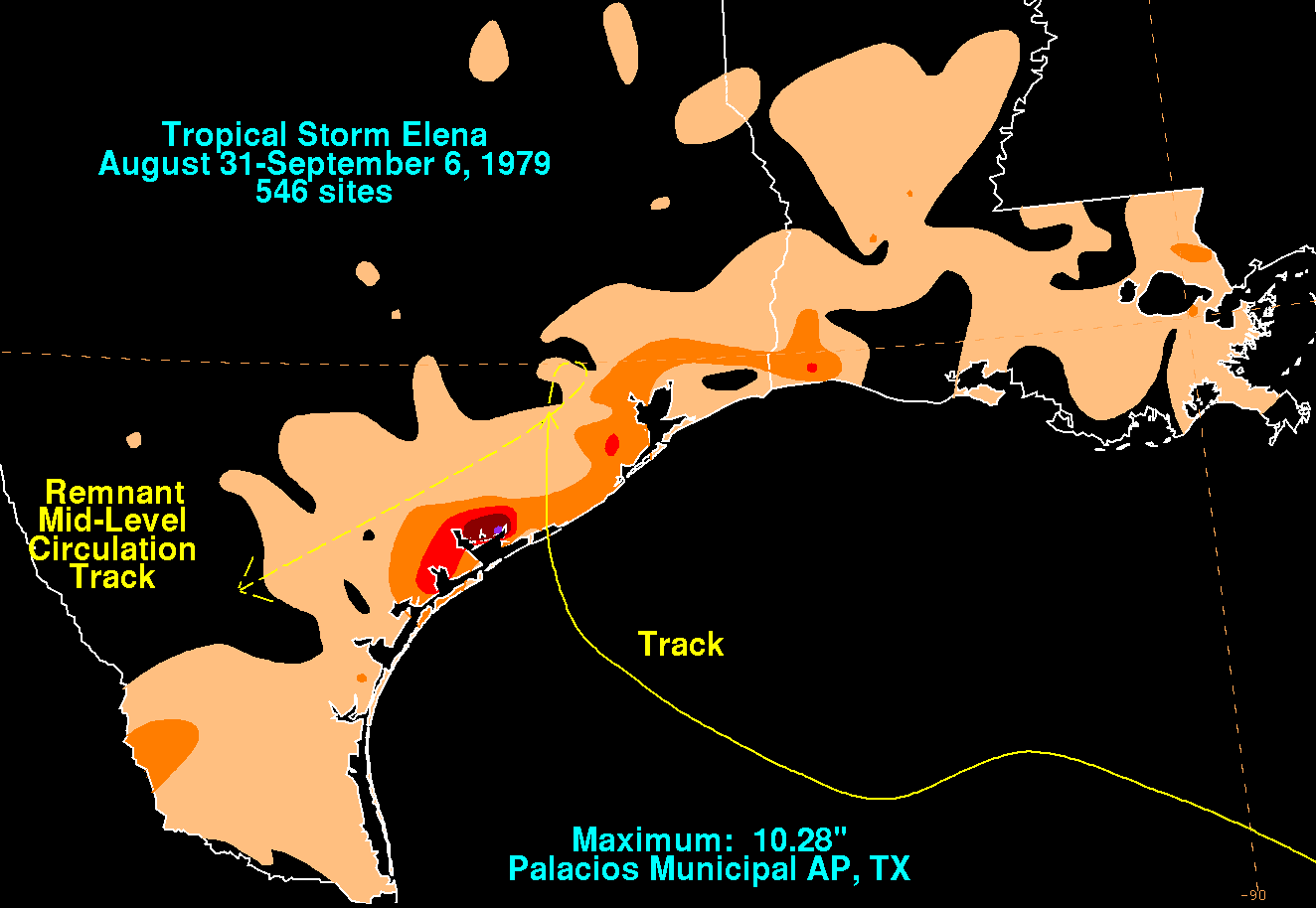
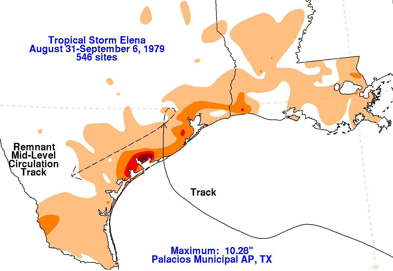
Below are the storm total rainfall maps for Elena, using data
provided
by the National Climatic Data Center.
 |
 |
 |