A tropical disturbance was spotted by TIROS satellite imagery on
September 28th in the middle of the tropical
Atlantic ocean. The system moved westward as a weak circulation,
which was slow to develop. By the morning
of the 29th, it had become a tropical depression. By the
afternoon of the 30th, Daisy had become a tropical storm
near the Leeward Islands. The cyclone began to turn northwest on
the 1st just offshore the Leeward Islands,
continuing this rough track for the next several days. Hurricane Daisy
began to accelerate northward offshore the
East coast, due to the presence of a coastal storm on the 5th.
Daisy slowed down as it absorbed the coastal low
southeast of Nantucket on the 6th, before recurving offshore Maine into
Nova Scotia.
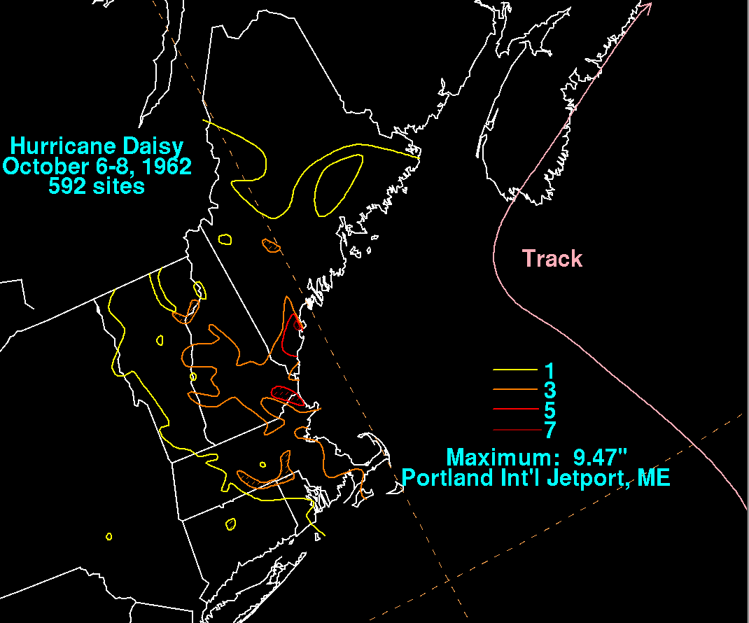
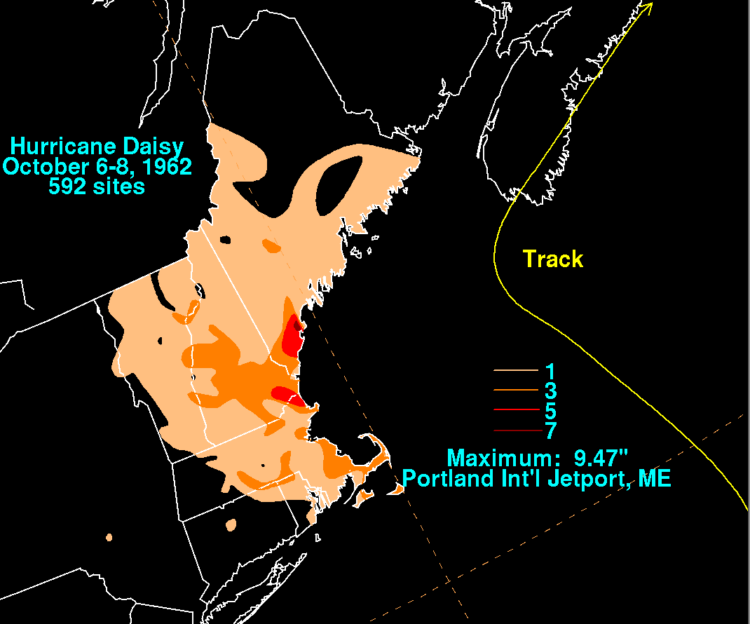
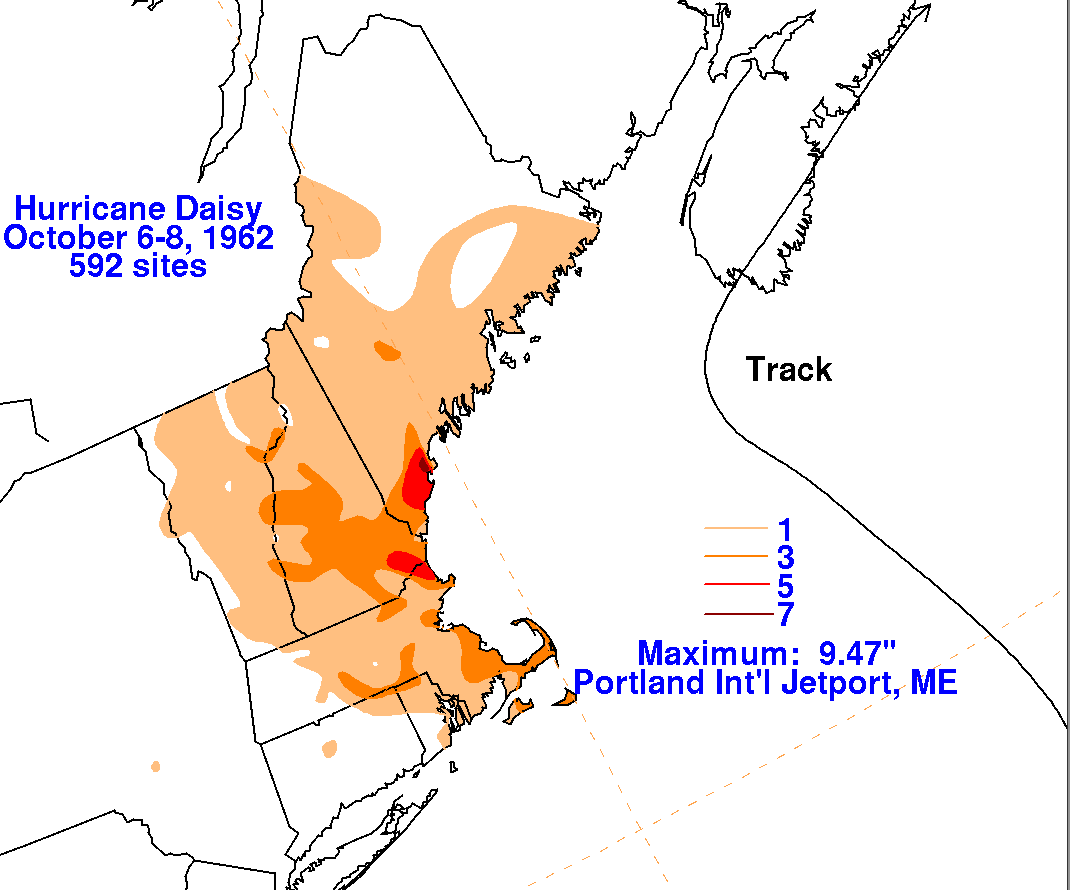
The combination of the coastal storm, Hurricane Daisy, and excessive
leaf fall caused by the two systems led to
record rainfall across southeast Massachusetts...only rainfall amounts
after the morning of October 6 were used to
compose the rainfall graphics below. The graphics below
show the storm total rainfall from Daisy. Rainfall data
was provided by the National Climatic Data Center in Asheville, North
Carolina and the Daily Weather Map series
for the 24 hour morning totals at Portland, Boston, and Nantucket.
 |
 |
 |