The tropical wave that spawned Claudette was the strongest of the season in the mid-levels of the troposphere, with 85 knot winds
being reported at the 550 hPa level at Dakar, Senegal on the morning of July 12. On the 16th, a surface circulation developed about
450 miles east of the Leeward Islands. When reconnaisance aircraft flew into the system around noon that day, the system was
already a tropical storm. Strong upper level westerly wind shear weakened the storm to a tropical depression over Puerto Rico,
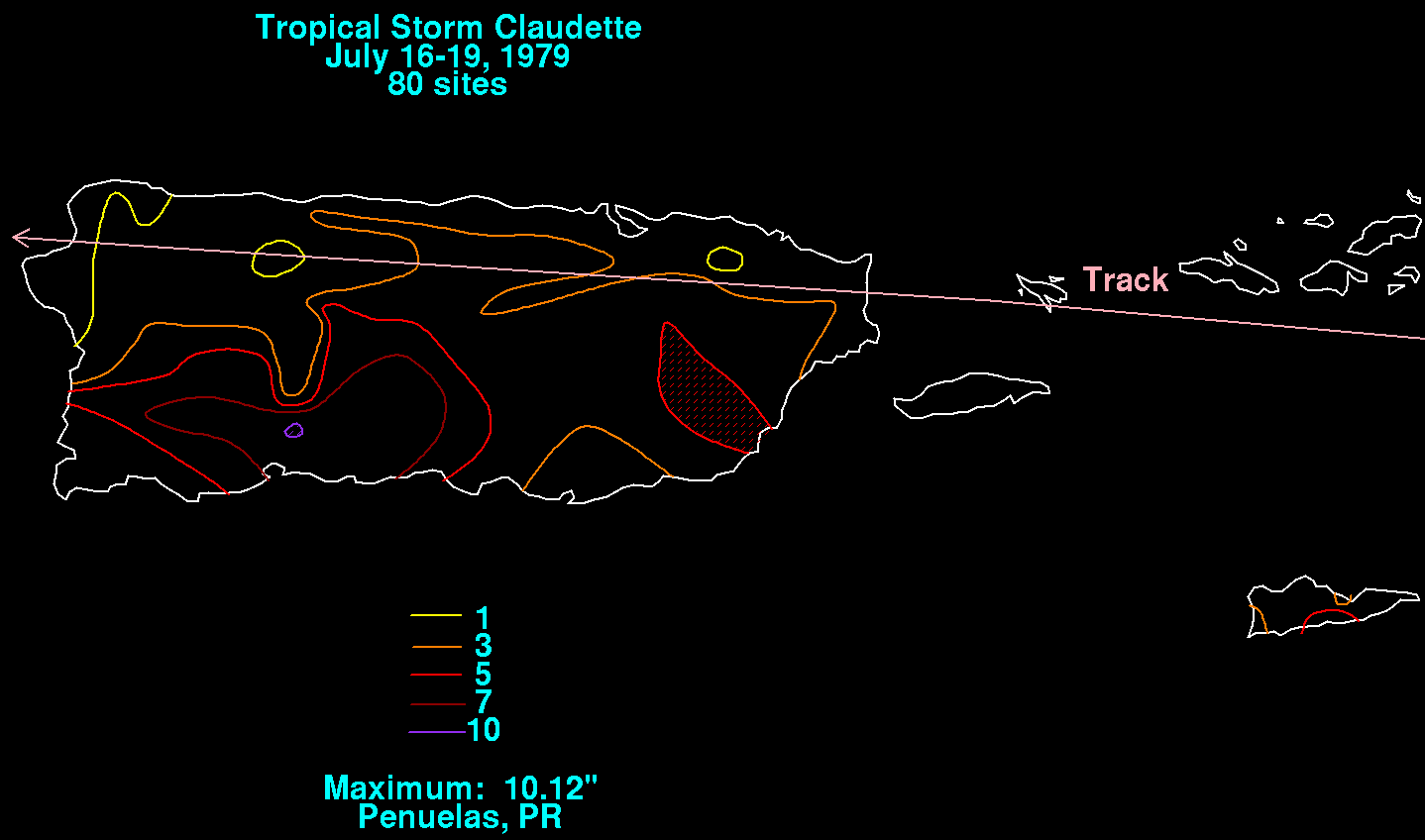
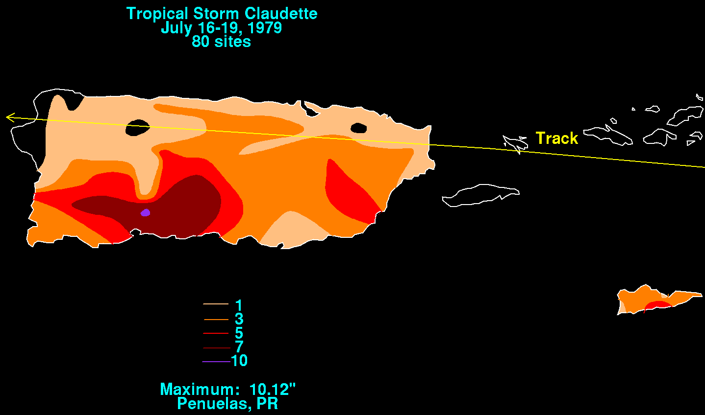
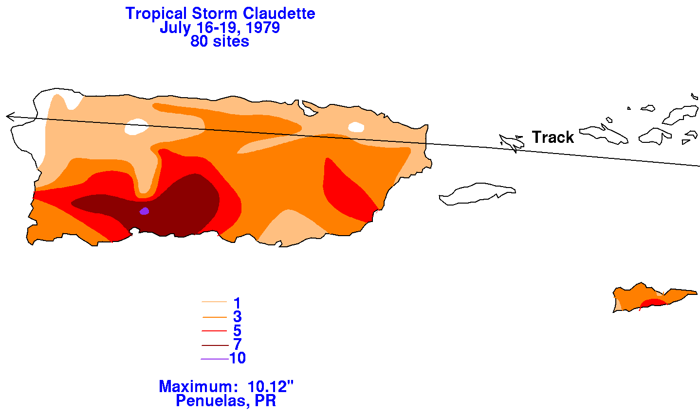
then into a tropical wave over Hispaniola. Rainfall of 7-8 inches caused some flooding on Guadeloupe. Amounts exceeding
9 inches fell in Puerto Rico, which led to flooding and one fatality. Below are maps showing the rainfall amounts across
Puerto Rico and St. Croix, prepared from data retrieved from the National Climatic Data Center in Asheville, North Carolina.
 |
 |
 |
As the tropical wave emerged into the Gulf of Mexico upper level conditions improved, and a tropical depression formed on the
morning of the 21st. Claudette reachieved tropical storm status by the 23rd, but its center remained poorly defined. As at least
two surface centers struggled for dominance, Claudette dropped back to tropical depression status late on the 23rd. A northern
center emerged victorious by the morning of the 24th, and the system became a tropical storm once more. That afternoon, the
cyclone moved inland near the Texas/Louisiana border.
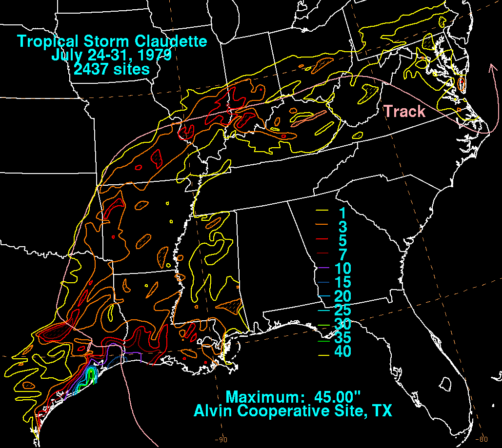
Initially it was thought the system would remain progressive, however, a blocking ridge formed to its north preventing recurvature
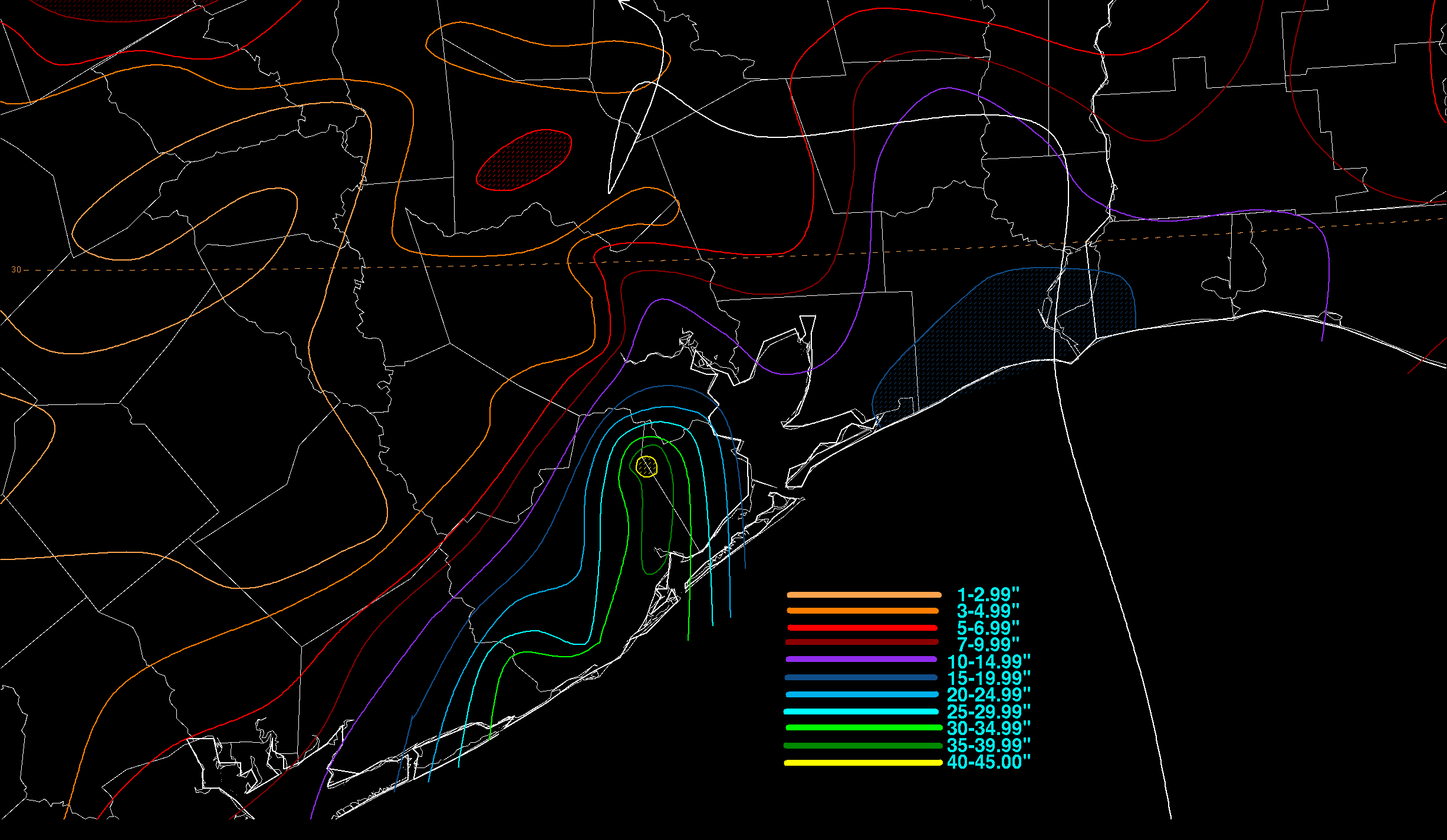
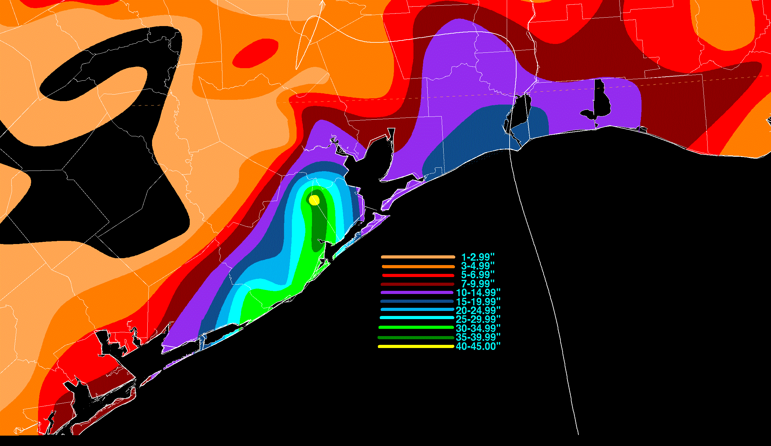
for an additional day, which led to extremely heavy rains between Alvin, Freeport, and Sergent in Texas. The 42 inches that
were measured at Alvin within a 24 hour period set a new 24 hour rainfall record for the United States. One died in Texas during
the ensuing flood. At the time, Claudette became the tenth costliest tropical cyclone in United States history, and the first not to
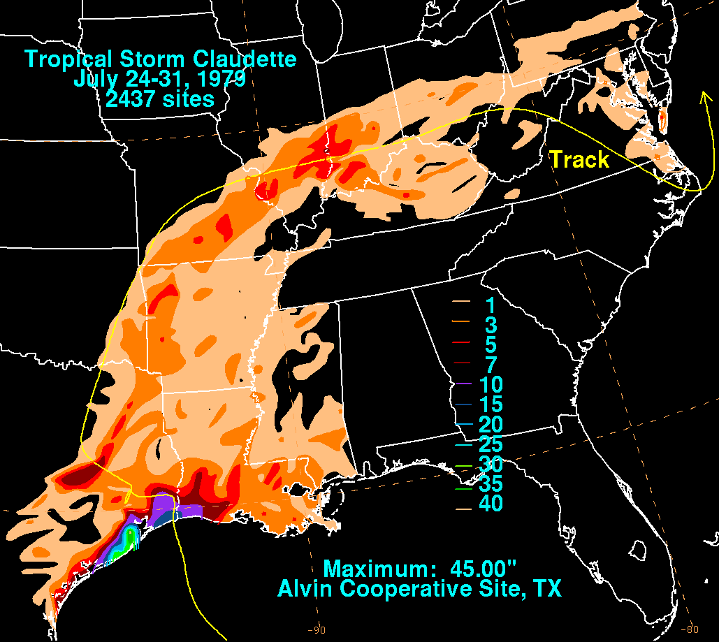
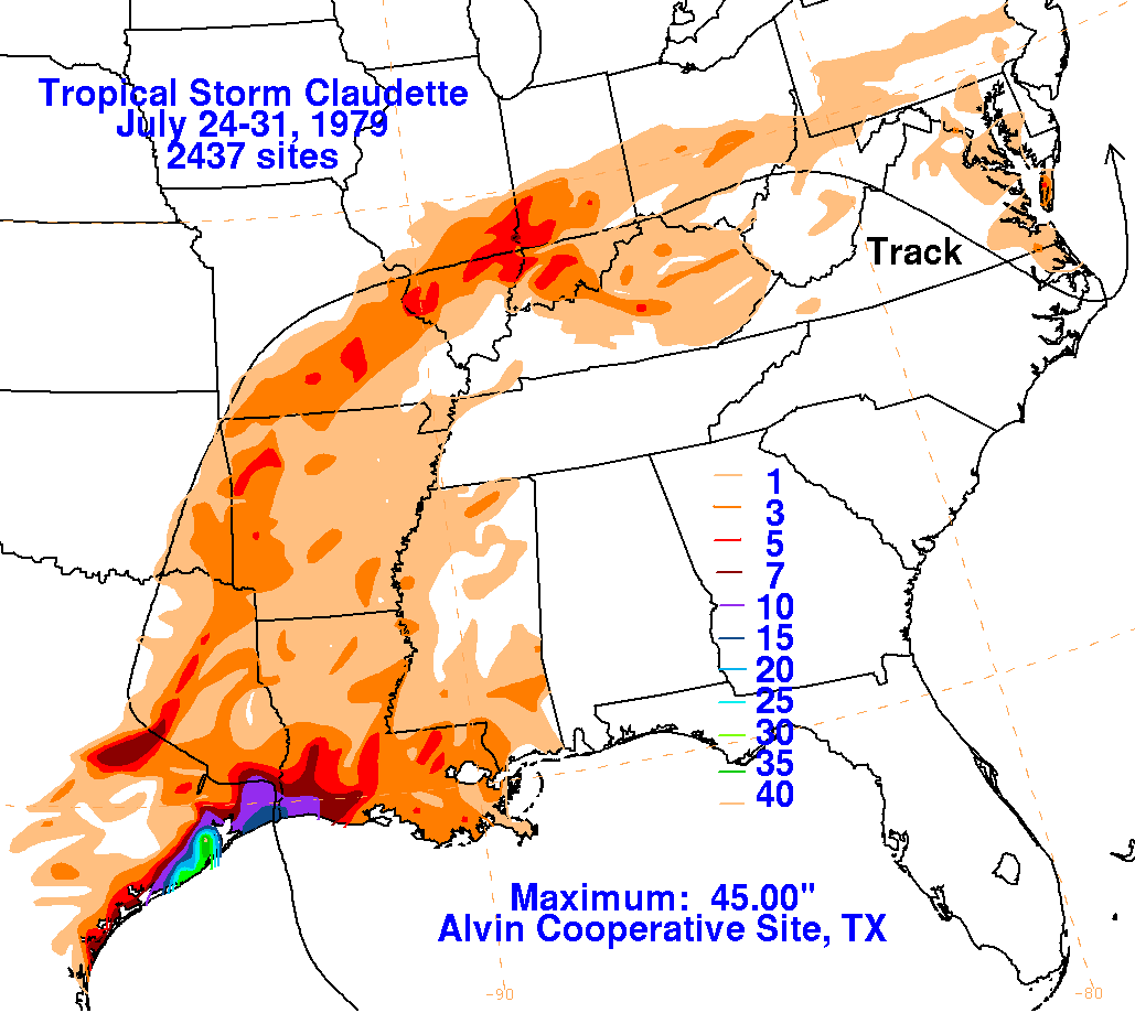
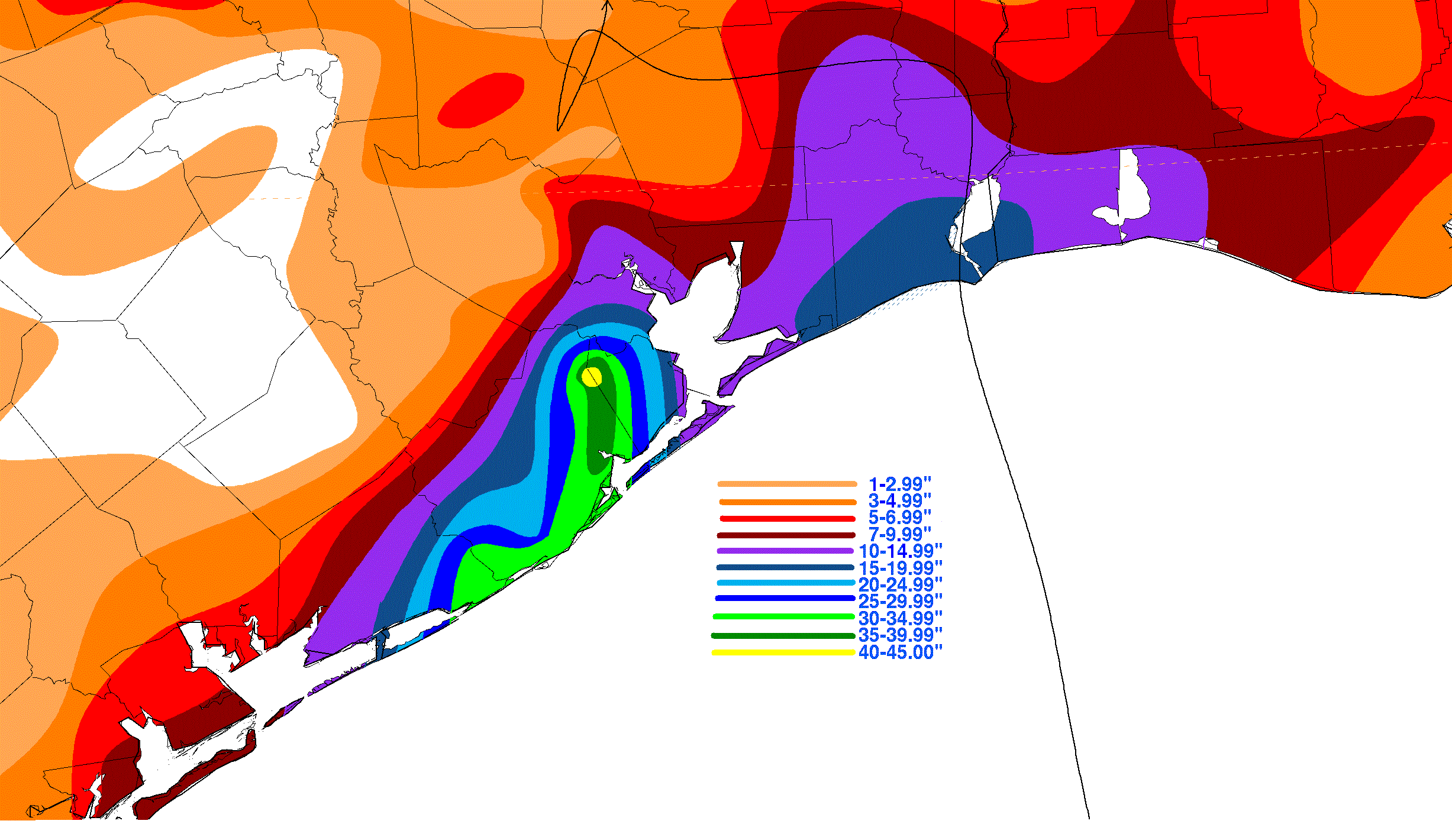
reach hurricane strength. The graphic below shows the storm total rainfall for Claudette, which used information from the
National Climatic Data Center in Asheville, North Carolina.
 |
 |
 |
Below are zoom-in images of southeast Texas.
 |
 |
 |