A strong tropical disturbance moved off the African coast on August 15th. The system moved west, reaching the
Leeward Islands on the 25th before interacting with an upper level low. The resulting broad surface circulation
moved west-northwest over the next few days to offshore the southeast Florida coast on the 28th as a cold core
cyclone, though convection was increasing with the low. Moving north to northeast ahead of a trough at higher
latitudes approached, the system strengthened into a tropical storm while east of North Carolina. As vertical
wind shear increased, development halted. By September 1st, its central pressure rose though gale force winds
remained in the pressure gradient 100 miles north of its center. Another trough in the Westerlies approached,
causing Carrie to redevelop baroclinically. Late on the 2nd, Carrie was no longer a tropical cyclone. The
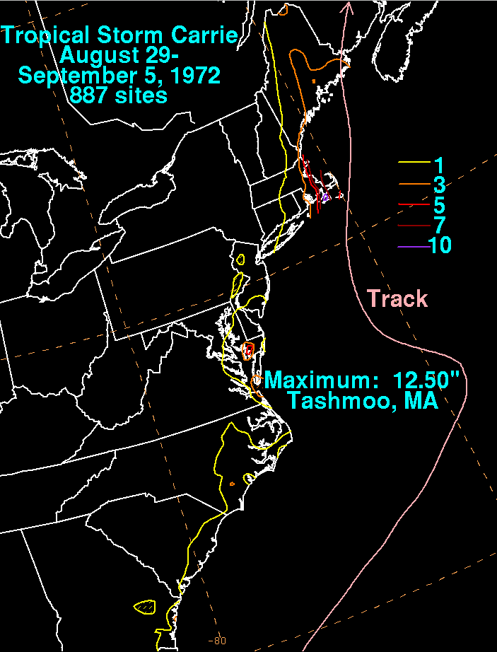
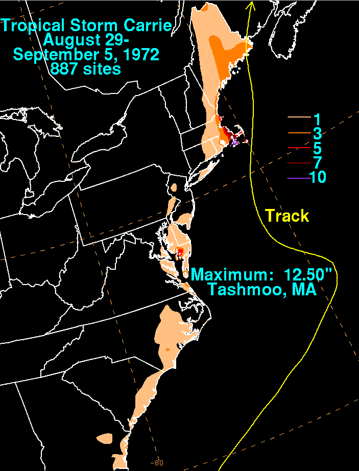
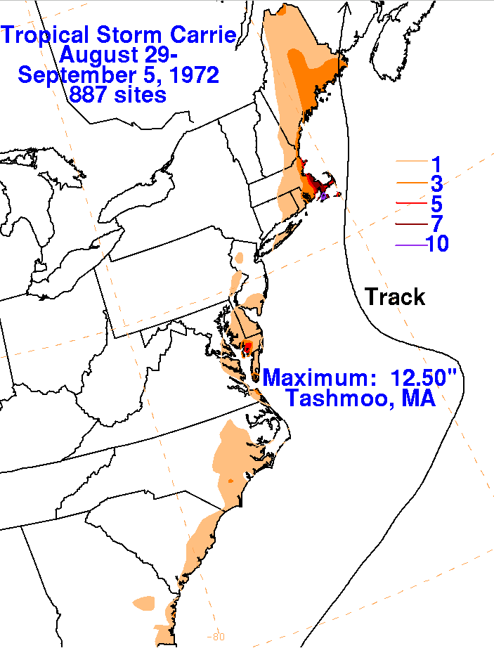
strengthening extratropical low skirted the coast of southern New England, bringing heavy rains to southeast
Massachusetts, with lowering amounts farther north into Maine to the west of the point of landfall. The graphics
below show the storm total rainfall for Carrie using data provided by the National Climatic Data Center in
Asheville, North Carolina. Carrie was the wettest storm of tropical origin for Massachusetts since Diane (1955).
 |
 |
 |