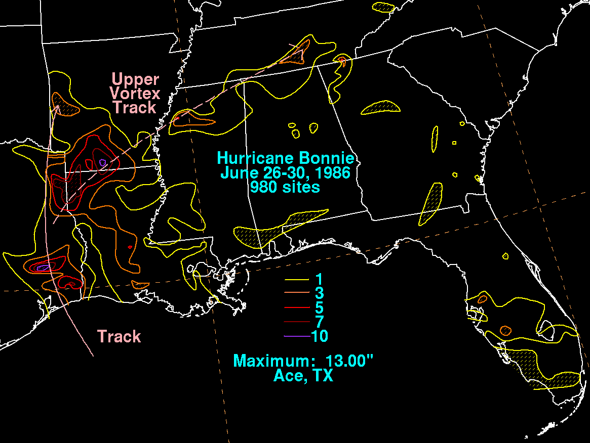
The early history of Bonnie is traced to a mid/upper level vortex
interacting with a stationary front
which layed across north Florida and the northeast Gulf of
Mexico. This system dropped southward
on the 20th with the vortex aloft dropping down towards the
surface. It reached low levels near Tampa
Bay on the 21st and 22nd. The low moved southwest without
organized deep convection and passed
south of the eastern Gulf buoy. Convection had finally organized
enough for the system to be classified
as a tropical depression on the afternoon of the 23rd.
Bonnie turned west-northwest at a slow pace, becoming a tropical
storm on the morning of the 24th. On
the 25th, the tropical cyclone moved slightly faster and continued to
strengthen. That morning, aircraft
reports indicated Bonnie had become a hurricane. The cyclone made
landfall immediately southwest
of Sea Rim State Park, located just west of the Sabine River in
Texas. Bonnie weakened rapidly at the
surface as it took a more northerly course through east Texas across
southeast Oklahoma. Around
this time, Bonnie's mid-level circulation tracked eastward
through northern Louisiana, Mississippi,
northwest Alabama, and into Tennessee without an identifiable
surface circulation, periodically dropping
moderate to heavy rainfall along its track. Below is a storm total
rainfall map for Bonnie. Rainfall
information was obtained from the National Climatic Data Center.
 |
 |
 |