A tropical wave moved off the African coast on July 19th, and there was very little activity near the wave
axis as it emerged into the Caribbean Sea on the 26th. By the 28th, as it approached the Yucatan peninsula,
an increase in thunderstorm activity was noted due to anticylonic flow aloft. By the 29th, the disturbance
took on a circular appearance in the southwest Gulf of Mexico, but no low level circulation had yet appeared.
On the 30th, a surface low was finally evident, and the system was declared a tropical depression. Amelia
became a storm by afternoon as it moved northwest. The cyclone skirted the lower Texas coast late that
day, and went ashore south of Corpus Christi during the night of the 30th/31st. The circulation was
followed inland to west of San Antonio on August 1st before becoming diffuse. Rainfall increased in
magnitude from then onward, with disastrous flooding occurring in many river basins, including the
Guadeloupe and its tributaries. Extensive damage occurred, and 30 people lost their lives in the flood.
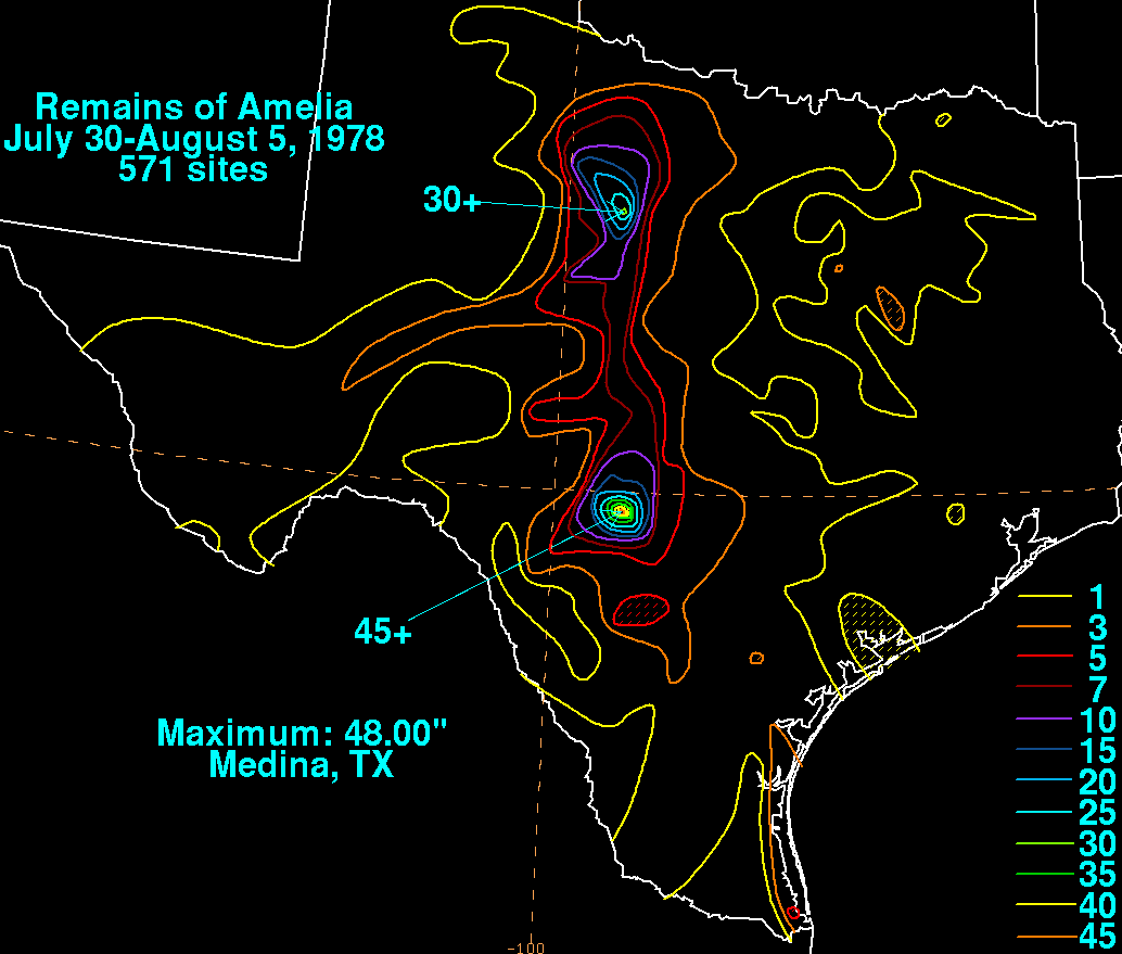
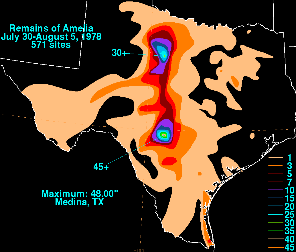
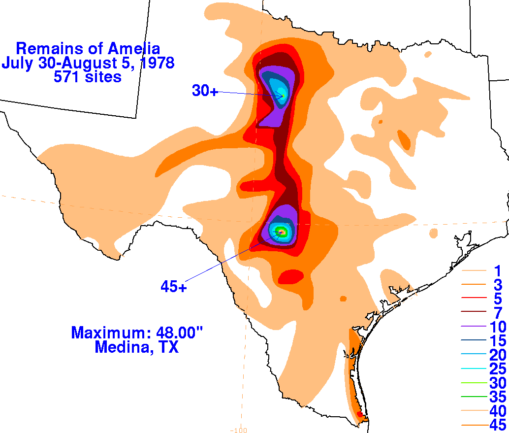
The graphic below shows the storm total rainfall for Amelia. The maxima in Texas occurred due to
mesoscale convective systems firing along a frontal boundary induced by Amelia's remnant
circulation aloft. Rainfall data was gathered from the National Climatic Data Center in Asheville,
North Carolina.
 |
 |
 |