

|
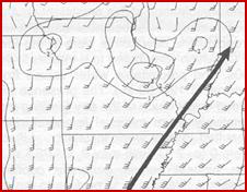
Surface analysis valid at 00 UTC 7 May 2000 |
|
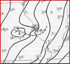
850 hPa analysis valid at 00 UTC 7 May 2000 |
|
The surface plot is fairly benign looking. The surface dewpoints are in the low 60s with very little in the way of a boundary to focus lifting. The NAM and GFS had very innocuous precipitation forecasts. The NAM predicted a little more than .50 inch just to the southwest of STL. The GFS had .50 inch or more, mostly in Illinois. Most forecasters would probably forecast some precipitation with the MCV and might beef up the models some.
|


|
0600 UTC RUC analysis of 950-hPa moisture convergence and wind (from Glass et al. 2001) |
|
1000 UTC RUC analysis of 950-hPa moisture convergence and wind (from Glass et al. 2001 |

|
0215 UTC 7 May 2000 infrared imagery |


|
0545 UTC 7 May 2000 infrared imagery |

|
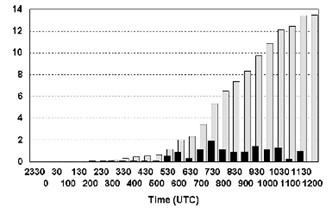
Time series of accumulated precipitation gray bars and 30 minute rainfall observations (black bars) for Union Missouri. (From Glass et al. 2001) |

|
Radar reflectivity for 0600 UTC 7 May 2000 (from Schumacher and Johnson 2005) |

|
Convection started to develop at around 02 UTC near the center of the circulation. Remember the NAM and GFS had some convective precipitation forecast in this general area but did not predict any amounts greater than 1.00 inch. Often the convection associated with MCVs produce their rainfall maximum at night. |
|
The 06 hr forecast sounding from the 00 UTC RUC indicated that the CAPE would be around 1000 J/kg at Union MO and that there would be a potent low level jet of 45 kts (see below). |
|
0600 UTC meso-surface analysis (from Glass et al. 2001) |
|
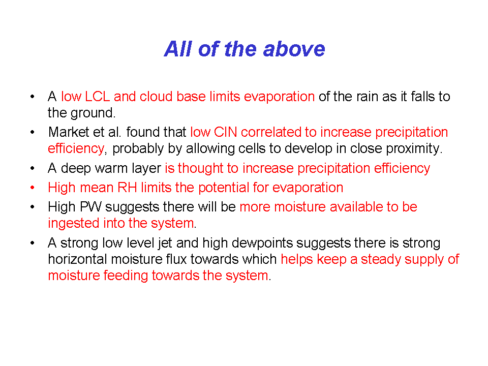
The RUC sounding above shows a number of factors that suggest that any MCS that forms and persists from 0215 UTC to 0600 UTC will probably produce high rainfall rates. Which of the following would support such a forecast?
|
|
The low LCL that suggests a low cloud base |
|
The low values of CIN |
|
The 12795 ft or 3.88 km freezing level that suggests a deep layer where warm rain collision coalescence processes can take place. |
|
The high mean RH and deep layer on the sounding that is near saturation. |
|
The 1.78 inch PW which is higher than the average value Maddox found associated with frontal or mesohigh type flash floods. |
|
The 45 kt low-level jet which along with the high PW which suggests the MCS will have no trouble replenishing the moisture that fall as rain. |
|
All of the above combined together suggest high rainfall rates are a good bet. |
|
The 6-h RUC sounding forecast did a good job of indicating there was potential for convection that could produce intense rain rates. |
|
Once convection developed, a low-level boundary became apparent along with a persistent area of moisture convergence. |
|
1000 UTC meso-surface analysis (from Glass et al. 2001 |
|
Radar reflectivity from 0900 UTC 07 May 2000 (from Schumacher and Johnson 2005) |
|
Convection continued to develop along the western edge of the boundary through around 1200 UTC. The southwest winds kept the moisture feeding into the boundary and new cells kept forming even as the old cells move east and weakened. This is a case where the MCV helped generate convection but then the MCV kept moving eastward. |
|
The observed rainfall rates at Union Missouri were in the 2-3 inch per hour range from 0630 UTC to 1030 UTC. If you were a forecasting in St Louis looking at a time cross section showing reflectivity, there was a big clue that heavy rainfall might be occurring, the high reflectivity area on the cross section was located below the freezing level. Therefore, it was unlikely that hail was causing the high reflectivity or that the NEXRAD algorithms would be overestimated rainfall rates. |
|
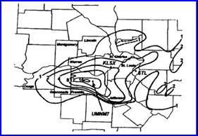
Precipitation analysis inched for the 24 hr period ending 1200 UTC 7 May 2000 (from Glass 2001). |
|
16 inched of rain fell just west of union which received more than 12. Not all MCVs produce such copious rainfall, in fact many dissipate without producing a second round of convection. |
|
MCVs are more likely to form and persist in regions of weak mid to upper level shear. A highly sheared environment is not favorable for their development or maintenance. If the surrounding airmass is moist and unstable there is a good possibility that a new round of convection will develop, such systems are especially dangerous if a low level jet develops and feeds moisture into upstream flank (usually southwestern flank) of the developing MCS (Trier and Davis 2002). |
|
Mesoscale Convective Vortex exercise (continued) |
|
In Summary |