A tropical wave which had moved off the coast of Africa began to be monitored for develop while southwest of Cabo Verde.
It showed signs of organization well to the east of the Leeward Islands on June 29th while moving swiftly to the west-northwest.
By very late on the 30th, its low-level circulation became better defined and it became a tropical depression about 1000 miles to
the east-southeast of the Leeward Islands. The system continued to developed and became a tropical storm later that night into
the early morning hours of July 1st. Elsa's upper level environment remained ideal, and it became a hurricane just south of
Barbados early on the 2nd. Continuing to move quite fast, Elsa began to experience northeast vertical wind shear and it weakened
back into a tropical storm. Soon afterward, the system slowed down across the northwest Caribbean Sea and passed just north
of Jamaica. On the afternoon of the 5th, Elsa crossed western Cuba as a tropical storm. Recurving through the eastern Gulf of
Mexico, Elsa briefly regained hurricane strength offshore western Florida, but vertical wind shear from the west-southwest
knocked its intensity quickly back down to a tropical storm. Elsa made landfall in Taylor County, FL on the 8th. Elsa
turned northeast as a tropical storm through the Southeast and accelerated. Briefly moving back offshore the Mid-Atlantic states,
Elsa made landfall in Long Island on the morning of the 9th, and then southern Rhode Island, before becoming post-tropical
that afternoon. Elsa raced across Atlantic Canada and the far north Atlantic on the 10th through 13th, and its circulation
dissipated near Iceland as it became absorbed by an approaching extratropical low.
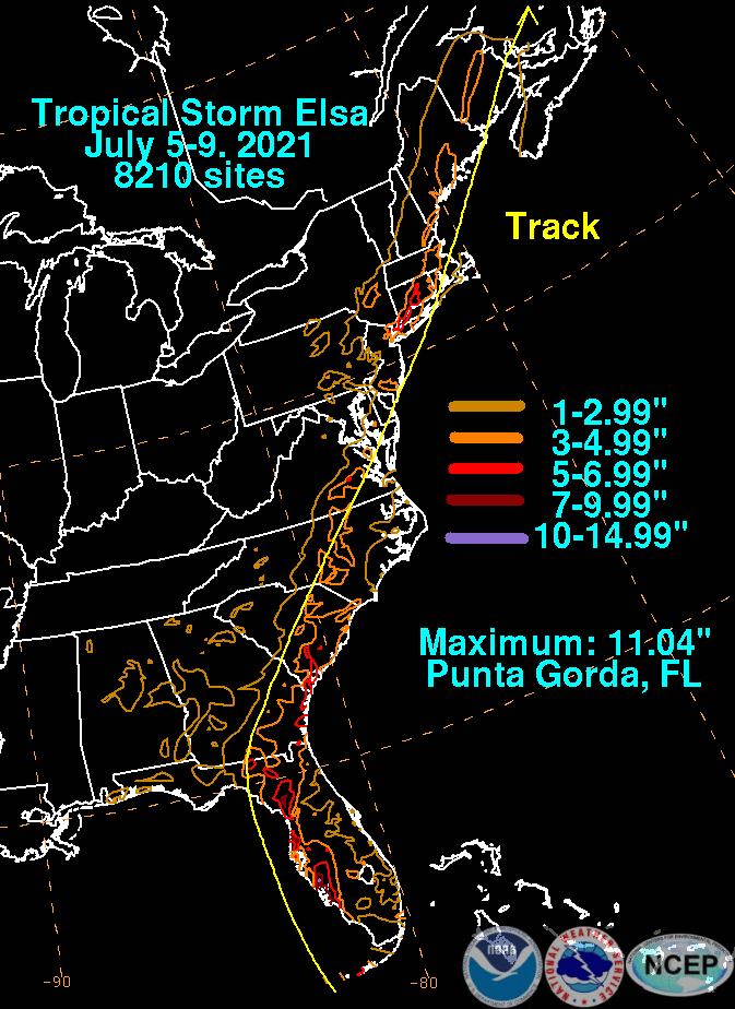
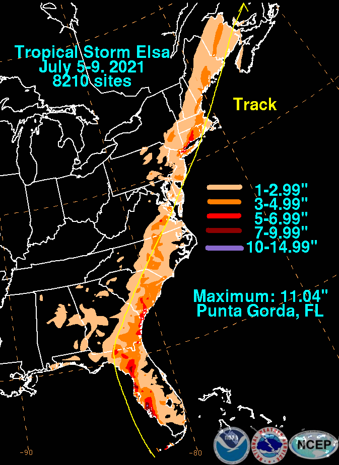
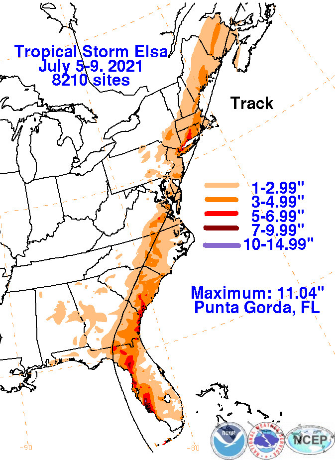
The graphics below show the storm total rainfall for Elsa, which used rain gage information from the National Weather
Service River Forecast Centers, Forecast Offices, and CoCoRAHS.
 |
 |
 |