Beulah intially developed into a tropical depression on the 5th as is was approaching the Lesser Antilles. It
strengthened into a tropical storm in the eastern Caribbean Sea on the 7th, becoming a hurricane late on the 8th
as it tracked westward. Strengthening continued into the 10th before the storm approached and interacted with the
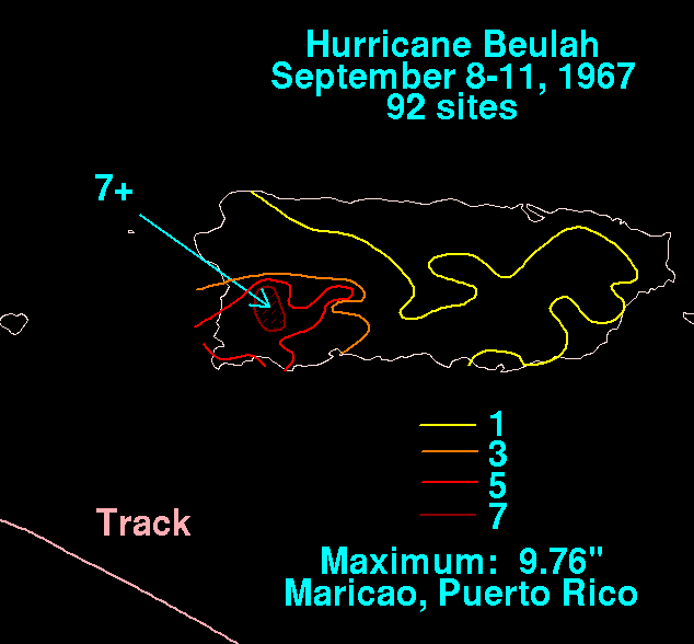
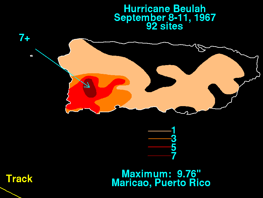
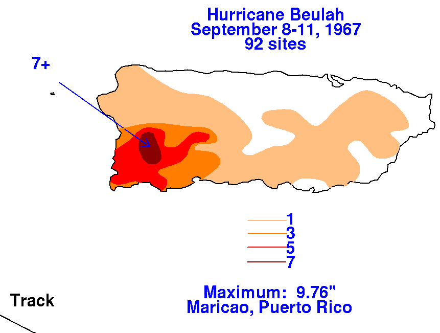
mountanous island of Hispanola. Below is a map showing the rainfall in Puerto Rico as Beulah passed by to the
south, constructed using data from the National Climatic Data Center in Asheville, North Carolina.
 |
 |
 |
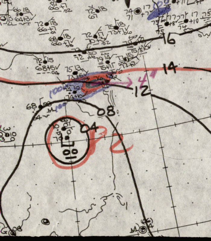
Moving across the western Caribbean as now a tropical storm, it slowly restrengthened into a hurricane, crossing
over the Yucatan peninsula on a west-northwest track on the 15th. The track bent more to the north, moving
north-northwest at 10 mph across the southern Gulf of Mexico. It deepened into a potent hurricane until it hit
the continental shelf, then weakened slowly as it moved west and southwest through southern Texas. It
produced a record number of tornadoes, with some counting as many as 146 separate event in this storm,
making it the most tornadic producing storm on record for the United States. Winds gusted to 136 mph on
the S.S. Shirley Lykes in the Port of Brownsville, with the Brownsville Weather Office recording gusts to 109
mph...their winds could have been higher since it was noted after the storm that their anemometer took on a 30
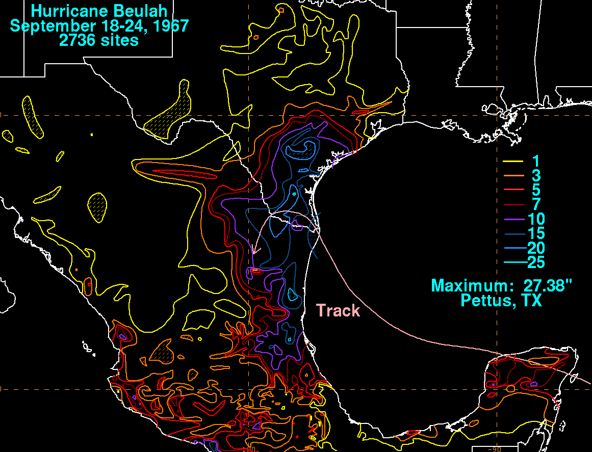
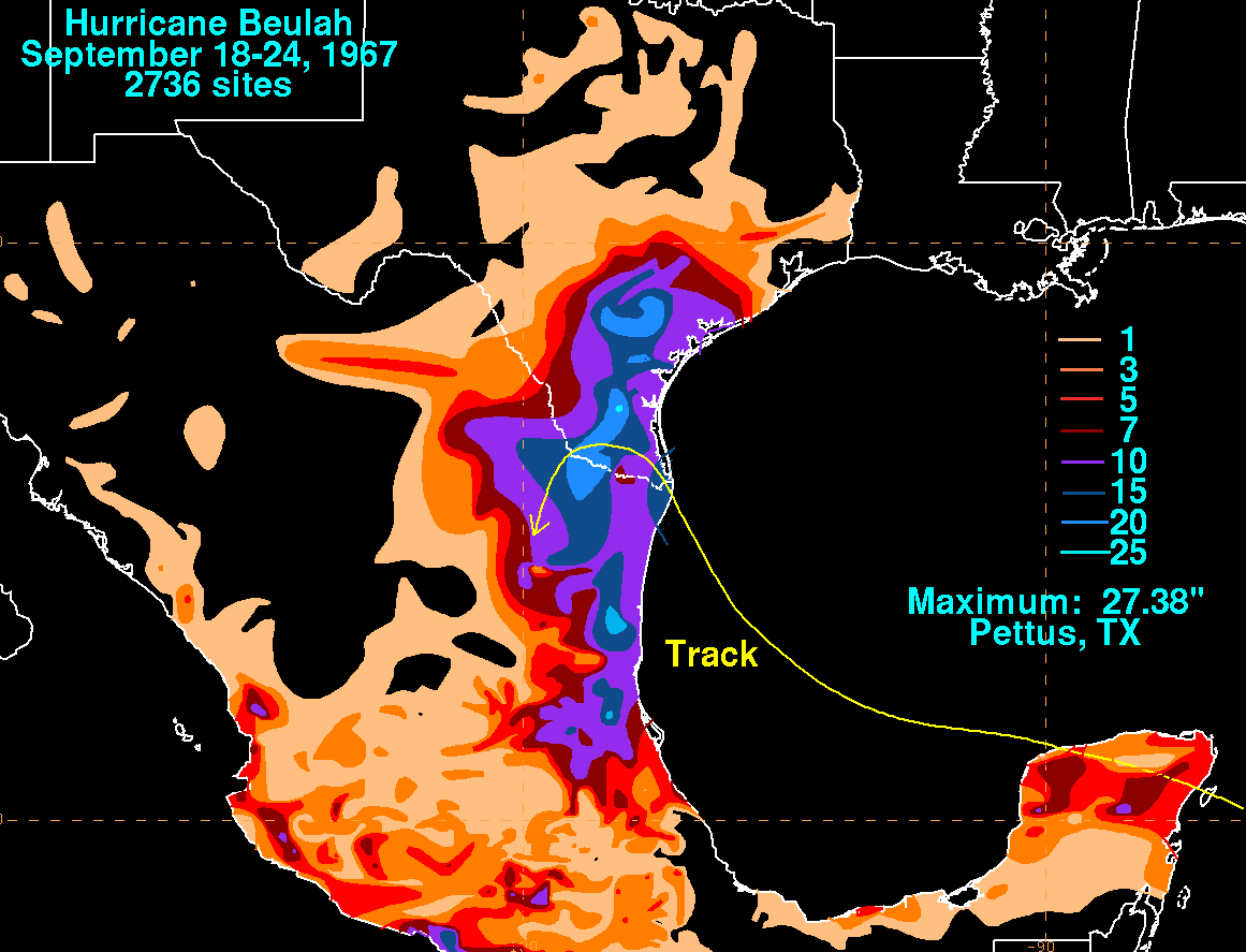
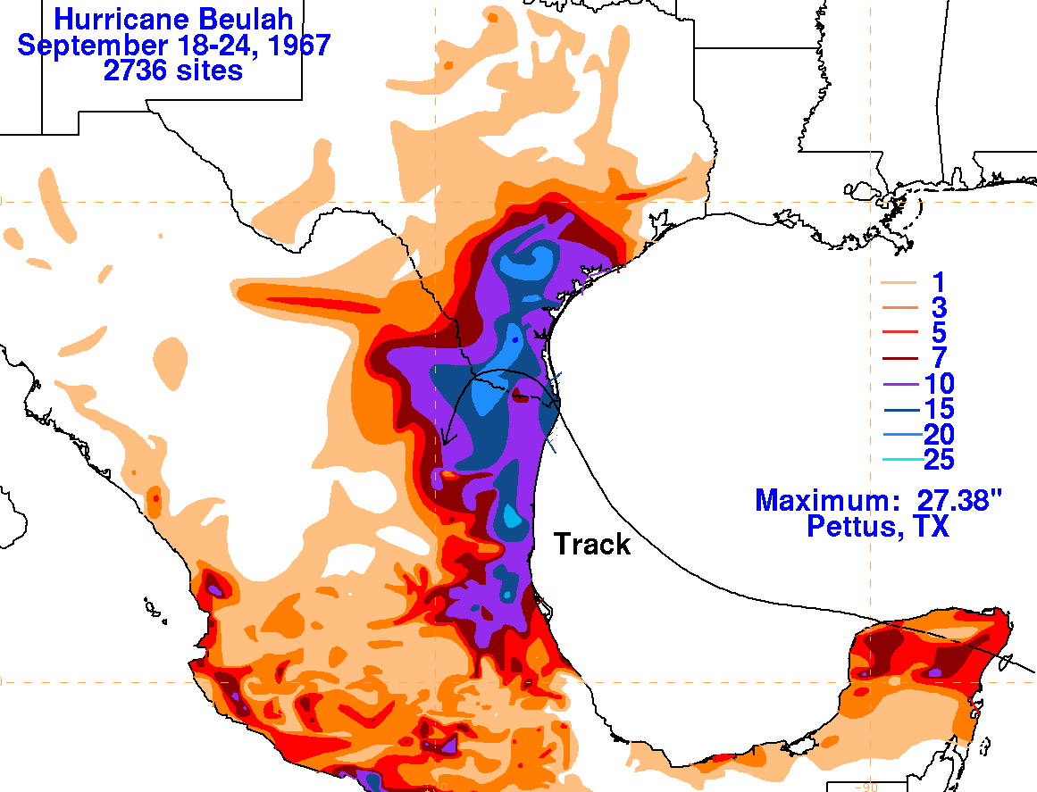
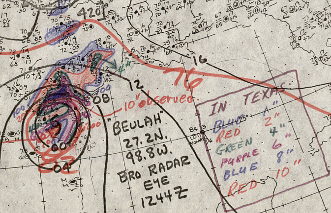
degree tilt during its fury. The graphics below show the storm total rainfall for Beulah, using data from the
National Climatic Data Center in Asheville, North Carolina and Comision Nacional del Agua, the parent
agency of Mexico's national weather service. Note the maximum across southern Texas...where Pettus
received over 27 inches of rain, most likely due to the shifting of the track from north-northwest to south,
which allowed rain bands to become essentially stationary across Bee county, Texas.
 |
 |
 |
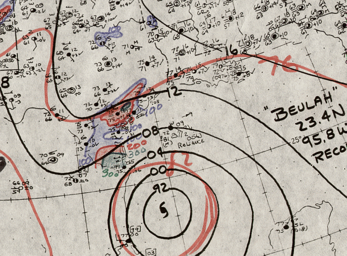
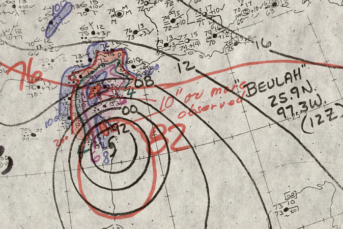
Below is the daily calendar of rainfall, with 24 hour amounts ending
at 12z in
the morning that day. Surface analyses
are from the start of the rainfall period (i.e. surface map from 17th
at 12z will underlay the precipitation which
falls between the 17th and 18th at 12z). The time 12z corresponds
to 8 am EDT, or 7 am CDT.
| Sun. |
Mon. |
Tue. |
Wed. |
Thu. |
Fri. |
Sat. |
| 20 |
21 |
22 |
23 |